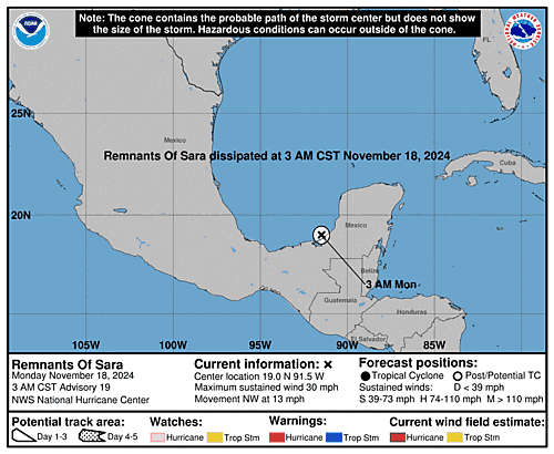
5-Day Uncertainty Track last updated Tue, 05 Nov 2024 23:55:59 GMT
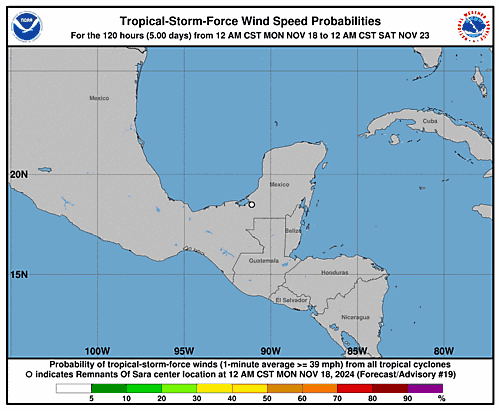
Wind Speed Probabilities last updated Tue, 05 Nov 2024 21:23:04 GMT
NHC Hurricane Advisories
, UTC by nhcauto
, UTC by atlanticnhc
Issued at 700 PM EST Tue Nov 05 2024
000 WTNT33 KNHC 052355 TCPAT3 BULLETIN Tropical Storm Rafael Intermediate Advisory Number 9A NWS National Hurricane Center Miami FL AL182024 700 PM EST Tue Nov 05 2024 ...RAFAEL NEAR HURRICANE INTENSITY AS IT APPROACHES THE CAYMAN ISLANDS... SUMMARY OF 700 PM EST...0000 UTC...INFORMATION ---------------------------------------------- LOCATION...19.3N 79.9W ABOUT 25 MI...45 KM SE OF LITTLE CAYMAN ABOUT 305 MI...495 KM SSE OF HAVANA CUBA MAXIMUM SUSTAINED WINDS...70 MPH...110 KM/H PRESENT MOVEMENT...NW OR 325 DEGREES AT 15 MPH...24 KM/H MINIMUM CENTRAL PRESSURE...987 MB...29.15 INCHES WATCHES AND WARNINGS -------------------- CHANGES WITH THIS ADVISORY: None. SUMMARY OF WATCHES AND WARNINGS IN EFFECT: A Hurricane Warning is in effect for... * Cayman Islands * Cuban provinces of Pinar del Rio, Artemisa, La Habana, Mayabeque, Matanzas, and the Isle of Youth A Tropical Storm Warning is in effect for... * Cuban provinces of Villa Clara, Cienfuegos, Sancti Spiritus, and Ciego de Avila * Lower and Middle Florida Keys from Key West to west of the Channel 5 Bridge * Dry Tortugas A Tropical Storm Watch is in effect for... * Cuban provinces of Camaguey and Las Tunas A Hurricane Warning means that hurricane conditions are expected somewhere within the warning area. A warning is typically issued 36 hours before the anticipated first occurrence of tropical-storm-force winds, conditions that make outside preparations difficult or dangerous. Preparations to protect life and property should be rushed to completion. A Tropical Storm Warning means that tropical storm conditions are expected somewhere within the warning area. A Tropical Storm Watch means that tropical storm conditions are possible within the watch area. Interests elsewhere in Cuba, the Florida Keys, and the southern Florida Peninsula should monitor the progress of Rafael. For storm information specific to your area in the United States, including possible inland watches and warnings, please monitor products issued by your local National Weather Service forecast office. For storm information specific to your area outside of the United States, please monitor products issued by your national meteorological service. DISCUSSION AND OUTLOOK ---------------------- At 700 PM EST (0000 UTC), the center of Tropical Storm Rafael was located by NOAA and Air Force Hurricane Hunter aircraft near latitude 19.3 North, longitude 79.9 West. Rafael is moving toward the northwest near 15 mph (24 km/h). A general northwestward motion is anticipated over the next several days. On the forecast track, the storm is expected to move near or over the Cayman Islands tonight, be near or over western Cuba on Wednesday, and move into the southeastern Gulf of Mexico by Wednesday night. Reports from Air Force Reserve and NOAA Hurricane Hunter aircraft indicate that maximum sustained winds remain near 70 mph (110 km/h) with higher gusts. Steady to rapid intensification is expected during the next 24 hour or so, and Rafael is expected to become a hurricane shortly as it passes near the Cayman Islands, with additional strengthening before it makes landfall in Cuba. Tropical-storm-force winds extend outward up to 115 miles (185 km) from the center. The minimum central pressure estimated from dropsonde data from the Hurricane Hunter aircraft is 987 mb (29.15 inches). HAZARDS AFFECTING LAND ---------------------- Key messages for Tropical Storm Rafael can be found in the Tropical Cyclone Discussion under AWIPS header MIATCDAT3 and WMO header WTNT43 KNHC and on the web at hurricanes.gov/text/MIATCDAT3.shtml WIND: Hurricane conditions are expected in the Cayman Islands by this evening and are also expected in western Cuba and the Isle of Youth on Wednesday. Tropical storm conditions are expected in parts of west-central Cuba and the lower and middle Florida Keys on Wednesday and Wednesday night. Tropical Storm conditions are possible farther east in central Cuba on Wednesday. RAINFALL: Heavy rainfall will impact areas of the western Caribbean through early Thursday, particularly across Jamaica and the Cayman Islands into southern and western portions of Cuba. Rainfall totals between 3 to 6 inches are expected, with isolated higher totals up to 10 inches anticipated across areas of higher terrain, which could lead to areas of flash flooding and mudslides. Rainfall totals of 1 to 3 inches are expected for the Lower and Middle Florida Keys. For a complete depiction of forecast rainfall associated with Tropical Storm Rafael, please see the National Weather Service Storm Total Rainfall Graphic, available at https://www.nhc.noaa.gov/graphics_at3.shtml?rainqpf STORM SURGE: Storm surge could raise water levels by 1 to 3 feet above normal tide levels in the Cayman Islands on Tuesday, and could raise water levels by as much as 6 to 9 feet above normal tide levels in areas of onshore winds along the southern coast of Cuba in the Hurricane Warning area, including the Isle of Youth. The combination of a storm surge and the tide will cause normally dry areas near the coast to be flooded by rising waters moving inland from the shoreline. The water could reach the following heights above ground somewhere in the indicated areas if the peak surge occurs at the time of high tide... Dry Tortugas...1-3 ft Lower Florida Keys...1-2 ft TORNADOES: A few tornadoes are possible Wednesday over the Keys and far southwestern Florida mainland. SURF: Swells generated by Rafael are expected to affect much of the western Caribbean during the next few days. These swells are likely to cause life-threatening surf and rip current conditions. Please consult products from your local weather office. NEXT ADVISORY ------------- Next complete advisory at 1000 PM EST. $$ Forecaster Papin
, UTC by nhcauto
Issued at 2100 UTC TUE NOV 05 2024
000 FONT13 KNHC 052041 PWSAT3 TROPICAL STORM RAFAEL WIND SPEED PROBABILITIES NUMBER 9 NWS NATIONAL HURRICANE CENTER MIAMI FL AL182024 2100 UTC TUE NOV 05 2024 AT 2100Z THE CENTER OF TROPICAL STORM RAFAEL WAS LOCATED NEAR LATITUDE 19.1 NORTH...LONGITUDE 79.6 WEST WITH MAXIMUM SUSTAINED WINDS NEAR 60 KTS...70 MPH...110 KM/H. Z INDICATES COORDINATED UNIVERSAL TIME (GREENWICH) ATLANTIC STANDARD TIME (AST)...SUBTRACT 4 HOURS FROM Z TIME EASTERN STANDARD TIME (EST)...SUBTRACT 5 HOURS FROM Z TIME CENTRAL STANDARD TIME (CST)...SUBTRACT 6 HOURS FROM Z TIME WIND SPEED PROBABILITY TABLE FOR SPECIFIC LOCATIONS CHANCES OF SUSTAINED (1-MINUTE AVERAGE) WIND SPEEDS OF AT LEAST ...34 KT (39 MPH... 63 KM/H)... ...50 KT (58 MPH... 93 KM/H)... ...64 KT (74 MPH...119 KM/H)... FOR LOCATIONS AND TIME PERIODS DURING THE NEXT 5 DAYS PROBABILITIES FOR LOCATIONS ARE GIVEN AS OP(CP) WHERE OP IS THE PROBABILITY OF THE EVENT BEGINNING DURING AN INDIVIDUAL TIME PERIOD (ONSET PROBABILITY) (CP) IS THE PROBABILITY OF THE EVENT OCCURRING BETWEEN 18Z TUE AND THE FORECAST HOUR (CUMULATIVE PROBABILITY) PROBABILITIES ARE GIVEN IN PERCENT X INDICATES PROBABILITIES LESS THAN 1 PERCENT PROBABILITIES FOR 34 KT AND 50 KT ARE SHOWN AT A GIVEN LOCATION WHEN THE 5-DAY CUMULATIVE PROBABILITY IS AT LEAST 3 PERCENT. PROBABILITIES FOR 34...50...64 KT SHOWN WHEN THE 5-DAY 64-KT CUMULATIVE PROBABILITY IS AT LEAST 1 PERCENT. - - - - WIND SPEED PROBABILITIES FOR SELECTED LOCATIONS - - - - FROM FROM FROM FROM FROM FROM FROM TIME 18Z TUE 06Z WED 18Z WED 06Z THU 18Z THU 18Z FRI 18Z SAT PERIODS TO TO TO TO TO TO TO 06Z WED 18Z WED 06Z THU 18Z THU 18Z FRI 18Z SAT 18Z SUN FORECAST HOUR (12) (24) (36) (48) (72) (96) (120) - - - - - - - - - - - - - - - - - - - - - - - - - - - - - - - - - - LOCATION KT GAINESVILLE FL 34 X X( X) 1( 1) 1( 2) 1( 3) X( 3) X( 3) THE VILLAGES 34 X X( X) 2( 2) 1( 3) 1( 4) X( 4) X( 4) ORLANDO FL 34 X X( X) 2( 2) 1( 3) 1( 4) X( 4) X( 4) COCOA BEACH FL 34 X X( X) 3( 3) 3( 6) X( 6) X( 6) X( 6) PATRICK AFB 34 X X( X) 3( 3) 3( 6) X( 6) 1( 7) X( 7) FT PIERCE FL 34 X 1( 1) 5( 6) 3( 9) X( 9) X( 9) X( 9) W PALM BEACH 34 X 3( 3) 6( 9) 3(12) X(12) X(12) X(12) FT LAUDERDALE 34 X 6( 6) 7(13) 3(16) X(16) X(16) X(16) MIAMI FL 34 X 3( 3) 4( 7) 2( 9) 1(10) X(10) X(10) HOMESTEAD ARB 34 X 4( 4) 4( 8) 2(10) X(10) X(10) X(10) MARATHON FL 34 3 22(25) 17(42) 3(45) 1(46) X(46) X(46) MARATHON FL 50 X 2( 2) 2( 4) 1( 5) X( 5) X( 5) X( 5) KEY WEST FL 34 3 31(34) 29(63) 2(65) 2(67) X(67) X(67) KEY WEST FL 50 X 3( 3) 9(12) 2(14) X(14) X(14) X(14) KEY WEST FL 64 X X( X) 3( 3) X( 3) X( 3) X( 3) X( 3) NAPLES FL 34 X 6( 6) 25(31) 5(36) 3(39) 1(40) X(40) NAPLES FL 50 X X( X) 2( 2) 1( 3) X( 3) X( 3) X( 3) FT MYERS FL 34 X 2( 2) 6( 8) 4(12) 2(14) X(14) X(14) VENICE FL 34 X 3( 3) 16(19) 9(28) 5(33) X(33) X(33) VENICE FL 50 X X( X) 1( 1) 1( 2) 1( 3) X( 3) X( 3) TAMPA FL 34 X 1( 1) 8( 9) 8(17) 5(22) X(22) X(22) CEDAR KEY FL 34 X X( X) 2( 2) 6( 8) 4(12) 1(13) X(13) ST MARKS FL 34 X X( X) X( X) 1( 1) 2( 3) X( 3) X( 3) APALACHICOLA 34 X X( X) 1( 1) 6( 7) 7(14) 2(16) X(16) GFMX 290N 850W 34 X X( X) 3( 3) 8(11) 9(20) 1(21) 1(22) PANAMA CITY FL 34 X X( X) X( X) 4( 4) 7(11) 2(13) 1(14) DESTIN EXEC AP 34 X X( X) X( X) 1( 1) 2( 3) 1( 4) 1( 5) WHITING FLD FL 34 X X( X) X( X) 1( 1) 1( 2) 1( 3) 1( 4) PENSACOLA FL 34 X X( X) X( X) 1( 1) 2( 3) 1( 4) 1( 5) GFMX 290N 870W 34 X X( X) 1( 1) 8( 9) 15(24) 3(27) 1(28) GFMX 290N 870W 50 X X( X) X( X) X( X) 2( 2) 1( 3) X( 3) MOBILE AL 34 X X( X) X( X) X( X) 2( 2) 2( 4) 1( 5) GULFPORT MS 34 X X( X) X( X) X( X) 2( 2) 3( 5) 1( 6) STENNIS MS 34 X X( X) X( X) X( X) 2( 2) 2( 4) 2( 6) BURAS LA 34 X X( X) X( X) 1( 1) 3( 4) 5( 9) 2(11) GFMX 280N 890W 34 X X( X) 1( 1) 6( 7) 22(29) 10(39) 2(41) GFMX 280N 890W 50 X X( X) X( X) X( X) 6( 6) 4(10) 1(11) GFMX 280N 890W 64 X X( X) X( X) X( X) 2( 2) 1( 3) X( 3) NEW ORLEANS LA 34 X X( X) X( X) X( X) 2( 2) 3( 5) 3( 8) HOUMA LA 34 X X( X) X( X) X( X) 2( 2) 4( 6) 3( 9) GFMX 280N 910W 34 X X( X) X( X) 1( 1) 12(13) 14(27) 5(32) GFMX 280N 910W 50 X X( X) X( X) X( X) 1( 1) 5( 6) 2( 8) GFMX 280N 910W 64 X X( X) X( X) X( X) X( X) 1( 1) X( 1) BATON ROUGE LA 34 X X( X) X( X) X( X) 1( 1) 2( 3) 2( 5) MORGAN CITY LA 34 X X( X) X( X) X( X) 1( 1) 4( 5) 3( 8) ALEXANDRIA LA 34 X X( X) X( X) X( X) X( X) 1( 1) 2( 3) LAFAYETTE LA 34 X X( X) X( X) X( X) 1( 1) 2( 3) 2( 5) NEW IBERIA LA 34 X X( X) X( X) X( X) 1( 1) 2( 3) 3( 6) GFMX 280N 930W 34 X X( X) X( X) X( X) 3( 3) 11(14) 6(20) GFMX 280N 930W 50 X X( X) X( X) X( X) X( X) 2( 2) 2( 4) GFMX 280N 930W 64 X X( X) X( X) X( X) X( X) 1( 1) X( 1) FORT POLK LA 34 X X( X) X( X) X( X) X( X) 1( 1) 2( 3) LAKE CHARLES 34 X X( X) X( X) X( X) X( X) 2( 2) 2( 4) CAMERON LA 34 X X( X) X( X) X( X) 1( 1) 6( 7) 5(12) JASPER TX 34 X X( X) X( X) X( X) X( X) 1( 1) 2( 3) KOUNTZE TX 34 X X( X) X( X) X( X) X( X) 1( 1) 2( 3) PORT ARTHUR TX 34 X X( X) X( X) X( X) X( X) 2( 2) 2( 4) GALVESTON TX 34 X X( X) X( X) X( X) 1( 1) 2( 3) 4( 7) GFMX 280N 950W 34 X X( X) X( X) X( X) 1( 1) 3( 4) 3( 7) HIGH ISLAND TX 34 X X( X) X( X) X( X) X( X) 2( 2) 2( 4) MATAGORDA TX 34 X X( X) X( X) X( X) X( X) 2( 2) 1( 3) PORT O CONNOR 34 X X( X) X( X) X( X) X( X) 1( 1) 2( 3) GFMX 270N 960W 34 X X( X) X( X) X( X) X( X) 2( 2) 2( 4) MERIDA MX 34 X X( X) X( X) X( X) 2( 2) X( 2) 1( 3) COZUMEL MX 34 X 2( 2) 2( 4) 2( 6) 3( 9) X( 9) 1(10) GRAND BAHAMA 34 X 1( 1) 2( 3) X( 3) X( 3) X( 3) X( 3) ANDROS 34 3 3( 6) 1( 7) X( 7) X( 7) X( 7) X( 7) CP SAN ANTONIO 34 2 4( 6) 10(16) 7(23) 3(26) 1(27) X(27) CP SAN ANTONIO 50 X 1( 1) 2( 3) 1( 4) 1( 5) X( 5) X( 5) HAVANA 34 1 75(76) 13(89) 1(90) X(90) X(90) X(90) HAVANA 50 X 34(34) 19(53) 1(54) X(54) X(54) X(54) HAVANA 64 X 4( 4) 4( 8) X( 8) X( 8) X( 8) X( 8) ISLE OF PINES 34 5 60(65) 3(68) 2(70) X(70) X(70) X(70) ISLE OF PINES 50 1 41(42) 2(44) X(44) X(44) X(44) X(44) ISLE OF PINES 64 X 14(14) 2(16) X(16) X(16) X(16) X(16) CIENFUEGOS 34 49 37(86) X(86) 1(87) X(87) X(87) X(87) CIENFUEGOS 50 2 14(16) 1(17) X(17) X(17) X(17) X(17) CIENFUEGOS 64 X 2( 2) X( 2) X( 2) X( 2) X( 2) X( 2) CAMAGUEY 34 3 2( 5) X( 5) X( 5) X( 5) X( 5) X( 5) GRAND CAYMAN 34 13 5(18) 1(19) X(19) X(19) X(19) 1(20) GRAND CAYMAN 50 2 1( 3) X( 3) X( 3) X( 3) X( 3) X( 3) MONTEGO BAY 34 99 X(99) X(99) X(99) X(99) X(99) X(99) KINGSTON 34 3 X( 3) X( 3) X( 3) X( 3) X( 3) X( 3) $$ FORECASTER BEVEN
, UTC by nhcauto
Issued at 400 PM EST Tue Nov 05 2024
000 WTNT43 KNHC 052041 TCDAT3 Tropical Storm Rafael Discussion Number 9 NWS National Hurricane Center Miami FL AL182024 400 PM EST Tue Nov 05 2024 Reports from an Air Force Reserve Hurricane Hunter aircraft and radar data from Grand Cayman indicate that Rafael has developed an inner wind core during the past several hours. The radar data shows the development of a ragged eye, and the Hurricane Hunter reported 850-mb flight-level winds of 73 kt about 30-35 n mi northeast of the center. The aircraft also reported that the central pressure has fallen to near 989 mb. Based on these data, the initial intensity is increased to 60 kt. The wind radii have been revised some based on the aircraft data. The initial motion is northwestward at 325/13 kt. Rafael is currently on the southwestern side of a low- to mid-level ridge over the western Atlantic, and this feature should steer the cyclone generally northwestward for the next 36-48 h, with the center passing near the Cayman Islands and over western Cuba. From 48-72 h, the models are in better agreement that the center should turn more westward as the ridge builds a little westward along the northern Gulf coast. After 72 h, there remains some significant spread in the track guidance, due partly to differences in how fast Rafael will shear apart and due partly to differences in the forecast strength of the ridge along the Gulf coast. The GFS weakens the ridge and shows a northward turn, while the ECMWF keeps a stronger ridge and shows a more westward motion. The deterministic UKMET has now changed to a northward turn scenario, but the HWRF, HMON, and UKMET ensemble mean join the ECMWF with a westward motion. As mentioned with the previous forecast, until there is a clearer signal on which of these scenarios is more likely, the forecast compromises between these extremes with a slow turn toward the north over the northern Gulf of Mexico. Now that Rafael has developed an inner wind core, conditions are favorable for steady to rapid strengthening during the next 24 h or so. The system is expected to reach hurricane strength during the next several hours as it passes through the Cayman Islands with additional strengthening before it reaches Cuba. While the peak intensity forecast is near the high end of the intensity guidance, there is a chance that Rafael could get stronger than currently forecast. Once the center is north of 25N in the Gulf of Mexico, the cyclone is likely to encounter increasing vertical wind shear, dry air entrainment, and cooler sea surface temperatures, which should lead to Rafael weakening and eventually shearing apart vertically. This part of the intensity forecast lies near or just above the intensity consensus. Key Messages: 1. Rafael is forecast to be a hurricane when it passes near or over the Cayman Islands during the next 12 hours, where damaging hurricane-force winds, a dangerous storm surge, and destructive waves are expected. Additional strengthening is expected before Rafael reaches western Cuba and the Isle of Youth on Wednesday. A hurricane warning is in effect for this region, where damaging hurricane-force winds, life-threatening storm surge, and destructive waves are also expected. 2. Tropical storm conditions are expected in the Lower and Middle Florida Keys beginning Wednesday and Wednesday night. 3. It is too soon to determine what, if any, impacts Rafael could bring to portions of the northern Gulf Coast. Residents in this area should regularly monitor updates to the forecast. 4. Rafael will bring areas of heavy rain across portions of the western Caribbean through early Thursday, including Jamaica and the Cayman Islands, along with southern and western portions of Cuba. Flash flooding and mudslides are possible along the higher terrain in Jamaica and Cuba. FORECAST POSITIONS AND MAX WINDS INIT 05/2100Z 19.1N 79.6W 60 KT 70 MPH 12H 06/0600Z 20.5N 80.7W 70 KT 80 MPH 24H 06/1800Z 22.5N 82.4W 80 KT 90 MPH 36H 07/0600Z 24.1N 83.8W 80 KT 90 MPH 48H 07/1800Z 25.0N 85.2W 80 KT 90 MPH 60H 08/0600Z 25.4N 86.5W 75 KT 85 MPH 72H 08/1800Z 25.8N 87.8W 65 KT 75 MPH 96H 09/1800Z 27.1N 90.1W 50 KT 60 MPH 120H 10/1800Z 28.8N 90.7W 40 KT 45 MPH $$ Forecaster Beven
, UTC by nhcauto
, UTC by atlanticnhc
Issued at 2100 UTC TUE NOV 05 2024
000 WTNT23 KNHC 052040 TCMAT3 TROPICAL STORM RAFAEL FORECAST/ADVISORY NUMBER 9 NWS NATIONAL HURRICANE CENTER MIAMI FL AL182024 2100 UTC TUE NOV 05 2024 TROPICAL STORM CENTER LOCATED NEAR 19.1N 79.6W AT 05/2100Z POSITION ACCURATE WITHIN 20 NM PRESENT MOVEMENT TOWARD THE NORTHWEST OR 325 DEGREES AT 13 KT ESTIMATED MINIMUM CENTRAL PRESSURE 989 MB MAX SUSTAINED WINDS 60 KT WITH GUSTS TO 75 KT. 50 KT....... 30NE 20SE 0SW 20NW. 34 KT.......100NE 90SE 20SW 30NW. 12 FT SEAS.. 60NE 75SE 70SW 75NW. WINDS AND SEAS VARY GREATLY IN EACH QUADRANT. RADII IN NAUTICAL MILES ARE THE LARGEST RADII EXPECTED ANYWHERE IN THAT QUADRANT. REPEAT...CENTER LOCATED NEAR 19.1N 79.6W AT 05/2100Z AT 05/1800Z CENTER WAS LOCATED NEAR 18.6N 79.1W FORECAST VALID 06/0600Z 20.5N 80.7W MAX WIND 70 KT...GUSTS 85 KT. 64 KT... 20NE 15SE 0SW 15NW. 50 KT... 40NE 30SE 0SW 30NW. 34 KT...100NE 100SE 20SW 40NW. FORECAST VALID 06/1800Z 22.5N 82.4W MAX WIND 80 KT...GUSTS 100 KT. 64 KT... 20NE 15SE 0SW 15NW. 50 KT... 40NE 30SE 15SW 30NW. 34 KT...100NE 90SE 30SW 50NW. FORECAST VALID 07/0600Z 24.1N 83.8W MAX WIND 80 KT...GUSTS 100 KT. 64 KT... 20NE 15SE 0SW 15NW. 50 KT... 40NE 30SE 20SW 30NW. 34 KT...100NE 90SE 40SW 60NW. FORECAST VALID 07/1800Z 25.0N 85.2W MAX WIND 80 KT...GUSTS 100 KT. 64 KT... 20NE 15SE 0SW 15NW. 50 KT... 40NE 30SE 20SW 30NW. 34 KT...100NE 90SE 40SW 70NW. FORECAST VALID 08/0600Z 25.4N 86.5W MAX WIND 75 KT...GUSTS 90 KT. 50 KT... 40NE 30SE 20SW 30NW. 34 KT...100NE 90SE 40SW 70NW. FORECAST VALID 08/1800Z 25.8N 87.8W MAX WIND 65 KT...GUSTS 80 KT. 50 KT... 40NE 30SE 20SW 30NW. 34 KT...100NE 90SE 50SW 80NW. EXTENDED OUTLOOK. NOTE...ERRORS FOR TRACK HAVE AVERAGED NEAR 125 NM ON DAY 4 AND 175 NM ON DAY 5...AND FOR INTENSITY NEAR 15 KT EACH DAY OUTLOOK VALID 09/1800Z 27.1N 90.1W MAX WIND 50 KT...GUSTS 60 KT. 50 KT... 30NE 0SE 0SW 0NW. 34 KT... 80NE 60SE 30SW 60NW. OUTLOOK VALID 10/1800Z 28.8N 90.7W MAX WIND 40 KT...GUSTS 50 KT. 34 KT... 50NE 0SE 0SW 50NW. REQUEST FOR 3 HOURLY SHIP REPORTS WITHIN 300 MILES OF 19.1N 79.6W INTERMEDIATE PUBLIC ADVISORY...WTNT33 KNHC/MIATCPAT3...AT 06/0000Z NEXT ADVISORY AT 06/0300Z $$ FORECASTER BEVEN
, UTC by atlanticnhc
Issued at 400 PM EST Tue Nov 05 2024
000 WTNT33 KNHC 052041 TCPAT3 BULLETIN Tropical Storm Rafael Advisory Number 9 NWS National Hurricane Center Miami FL AL182024 400 PM EST Tue Nov 05 2024 ...RAFAEL STRENGTHENING AS IT HEADS TOWARDS THE CAYMAN ISLANDS... SUMMARY OF 400 PM EST...2100 UTC...INFORMATION ---------------------------------------------- LOCATION...19.1N 79.6W ABOUT 105 MI...170 KM E OF GRAND CAYMAN ABOUT 120 MI...190 KM WNW OF MONTEGO BAY JAMAICA MAXIMUM SUSTAINED WINDS...70 MPH...110 KM/H PRESENT MOVEMENT...NW OR 325 DEGREES AT 15 MPH...24 KM/H MINIMUM CENTRAL PRESSURE...989 MB...29.21 INCHES WATCHES AND WARNINGS -------------------- CHANGES WITH THIS ADVISORY: The Meteorological Service of Jamaica has discontinued the Tropical Storm Warning for Jamaica. SUMMARY OF WATCHES AND WARNINGS IN EFFECT: A Hurricane Warning is in effect for... * Cayman Islands * Cuban provinces of Pinar del Rio, Artemisa, La Habana, Mayabeque, Matanzas, and the Isle of Youth A Tropical Storm Warning is in effect for... * Cuban provinces of Villa Clara, Cienfuegos, Sancti Spiritus, and Ciego de Avila * Lower and Middle Florida Keys from Key West to west of the Channel 5 Bridge * Dry Tortugas A Tropical Storm Watch is in effect for... * Cuban provinces of Camaguey and Las Tunas A Hurricane Warning means that hurricane conditions are expected somewhere within the warning area. A warning is typically issued 36 hours before the anticipated first occurrence of tropical-storm-force winds, conditions that make outside preparations difficult or dangerous. Preparations to protect life and property should be rushed to completion. A Tropical Storm Warning means that tropical storm conditions are expected somewhere within the warning area. A Tropical Storm Watch means that tropical storm conditions are possible within the watch area. Interests elsewhere in Cuba, the Florida Keys, and the southern Florida Peninsula should monitor the progress of Rafael. For storm information specific to your area in the United States, including possible inland watches and warnings, please monitor products issued by your local National Weather Service forecast office. For storm information specific to your area outside of the United States, please monitor products issued by your national meteorological service. DISCUSSION AND OUTLOOK ---------------------- At 400 PM EST (2100 UTC), the center of Tropical Storm Rafael was located near latitude 19.1 North, longitude 79.6 West. Rafael is moving toward the northwest near 15 mph (24 km/h). A general northwestward motion is anticipated over the next two to three days. On the forecast track, the storm is expected to move near or over the Cayman Islands this evening and tonight, be near or over western Cuba on Wednesday, and move into the southeastern Gulf of Mexico by Wednesday night. Reports from an Air Force Reserve Hurricane Hunter aircraft indicate that maximum sustained winds have increased to near 70 mph (110 km/h) with higher gusts. Steady to rapid intensification is expected during the next 24 hour or so, and Rafael is expected to become a hurricane during the next several hours as it passes near the Cayman Islands with further strengthening before it makes landfall in Cuba. Tropical-storm-force winds extend outward up to 115 miles (185 km) from the center. The minimum central pressure estimated from the Hurricane Hunter aircraft data is 989 mb (29.21 inches). HAZARDS AFFECTING LAND ---------------------- Key messages for Tropical Storm Rafael can be found in the Tropical Cyclone Discussion under AWIPS header MIATCDAT3 and WMO header WTNT43 KNHC and on the web at hurricanes.gov/text/MIATCDAT3.shtml WIND: Hurricane conditions are expected in the Cayman Islands by this evening and are also expected in western Cuba and the Isle of Youth on Wednesday. Tropical storm conditions are expected in parts of west-central Cuba and the lower and middle Florida Keys on Wednesday and Wednesday night. Tropical Storm conditions are possible farther east in central Cuba on Wednesday. RAINFALL: Heavy rainfall will impact areas of the western Caribbean through early Thursday, particularly across Jamaica and the Cayman Islands into southern and western portions of Cuba. Rainfall totals between 3 to 6 inches are expected, with isolated higher totals up to 10 inches anticipated across areas of higher terrain, which could lead to areas of flash flooding and mudslides. Rainfall totals of 1 to 3 inches are expected for the Lower and Middle Florida Keys. For a complete depiction of forecast rainfall associated with Tropical Storm Rafael, please see the National Weather Service Storm Total Rainfall Graphic, available at https://www.nhc.noaa.gov/graphics_at3.shtml?rainqpf STORM SURGE: Storm surge could raise water levels by 1 to 3 feet above normal tide levels in the Cayman Islands on Tuesday, and could raise water levels by as much as 6 to 9 feet above normal tide levels in areas of onshore winds along the southern coast of Cuba in the Hurricane Warning area, including the Isle of Youth. The combination of a storm surge and the tide will cause normally dry areas near the coast to be flooded by rising waters moving inland from the shoreline. The water could reach the following heights above ground somewhere in the indicated areas if the peak surge occurs at the time of high tide... Dry Tortugas...1-3 ft Lower Florida Keys...1-2 ft TORNADOES: A few tornadoes are possible Wednesday over the Keys and far southwestern Florida mainland. SURF: Swells generated by Rafael are expected to affect much of the western Caribbean during the next few days. These swells are likely to cause life-threatening surf and rip current conditions. Please consult products from your local weather office. NEXT ADVISORY ------------- Next intermediate advisory at 700 PM EST. Next complete advisory at 1000 PM EST. $$ Forecaster Beven
, UTC by nhcauto
, UTC by atlanticnhc
Issued at 100 PM EST Tue Nov 05 2024
000 WTNT33 KNHC 051739 TCPAT3 BULLETIN Tropical Storm Rafael Intermediate Advisory Number 8A NWS National Hurricane Center Miami FL AL182024 100 PM EST Tue Nov 05 2024 ...CENTER OF RAFAEL NOW WEST OF THE WESTERN END OF JAMAICA... SUMMARY OF 100 PM EST...1800 UTC...INFORMATION ---------------------------------------------- LOCATION...18.6N 79.1W ABOUT 70 MI...115 KM SW OF MONTEGO BAY JAMAICA ABOUT 150 MI...240 KM ESE OF GRAND CAYMAN MAXIMUM SUSTAINED WINDS...60 MPH...95 KM/H PRESENT MOVEMENT...NW OR 320 DEGREES AT 14 MPH...23 KM/H MINIMUM CENTRAL PRESSURE...994 MB...29.36 INCHES WATCHES AND WARNINGS -------------------- CHANGES WITH THIS ADVISORY: None. SUMMARY OF WATCHES AND WARNINGS IN EFFECT: A Hurricane Warning is in effect for... * Cayman Islands * Cuban provinces of Pinar del Rio, Artemisa, La Habana, Mayabeque, Matanzas, and the Isle of Youth A Tropical Storm Warning is in effect for... * Jamaica * Cuban provinces of Villa Clara, Cienfuegos, Sancti Spiritus, and Ciego de Avila * Lower and Middle Florida Keys from Key West to west of the Channel 5 Bridge * Dry Tortugas A Tropical Storm Watch is in effect for... * Cuban provinces of Camaguey and Las Tunas A Hurricane Warning means that hurricane conditions are expected somewhere within the warning area. A warning is typically issued 36 hours before the anticipated first occurrence of tropical-storm-force winds, conditions that make outside preparations difficult or dangerous. Preparations to protect life and property should be rushed to completion. A Tropical Storm Warning means that tropical storm conditions are expected somewhere within the warning area. A Tropical Storm Watch means that tropical storm conditions are possible within the watch area. Interests elsewhere in Cuba, the Florida Keys, and the southern Florida Peninsula should monitor the progress of Rafael. For storm information specific to your area in the United States, including possible inland watches and warnings, please monitor products issued by your local National Weather Service forecast office. For storm information specific to your area outside of the United States, please monitor products issued by your national meteorological service. DISCUSSION AND OUTLOOK ---------------------- At 100 PM EST (1800 UTC), the center of Tropical Storm Rafael was located near latitude 18.6 North, longitude 79.1 West. Rafael is moving toward the northwest near 14 mph (23 km/h). A generally northwestward motion is anticipated over the next few days. On the forecast track, the storm is expected to move away from western Jamaica this afternoon, and be near or over the Cayman Islands this evening and tonight, and be near or over western Cuba on Wednesday. Maximum sustained winds are near 60 mph (95 km/h) with higher gusts. Steady to rapid intensification is expected during the next 24 to 36 hours, and Rafael is expected to become a hurricane as it passes near the Cayman Islands with further strengthening before it makes landfall in Cuba. Tropical-storm-force winds extend outward up to 105 miles (165 km) from the center. The minimum central pressure recently reported by an Air Force Reserve Hurricane Hunter aircraft is 994 mb (29.36 inches). HAZARDS AFFECTING LAND ---------------------- Key messages for Tropical Storm Rafael can be found in the Tropical Cyclone Discussion under AWIPS header MIATCDAT3 and WMO header WTNT43 KNHC and on the web at hurricanes.gov/text/MIATCDAT3.shtml WIND: Hurricane conditions are expected in the Cayman Islands by this evening and are also expected in western Cuba and the Isle of Youth on Wednesday. Tropical storm conditions are expected in Jamaica for several more hours and are expected in parts of west-central Cuba and the lower and middle Florida Keys on Wednesday and Wednesday night. Tropical Storm conditions are possible farther east in central Cuba on Wednesday. RAINFALL: Heavy rainfall will impact areas of the Western Caribbean through early Thursday, particularly across Jamaica and the Cayman Islands into southern and western portions of Cuba. Rainfall totals between 3 to 6 inches are expected, with isolated higher totals up to 10 inches anticipated across areas of higher terrain, which could lead to areas of flash flooding and mudslides. Rainfall totals of 1 to 3 inches are expected for the Lower and Middle Florida Keys. For a complete depiction of forecast rainfall associated with Tropical Storm Rafael, please see the National Weather Service Storm Total Rainfall Graphic, available at https://www.nhc.noaa.gov/graphics_at3.shtml?rainqpf STORM SURGE: Minor coastal flooding is possible in Jamaica tonight. Storm surge could raise water levels by 1 to 3 feet above normal tide levels in the Cayman Islands on Tuesday, and could raise water levels by as much as 6 to 9 feet above normal tide levels in areas of onshore winds along the southern coast of Cuba in the Hurricane Warning area, including the Isle of Youth. The combination of a storm surge and the tide will cause normally dry areas near the coast to be flooded by rising waters moving inland from the shoreline. The water could reach the following heights above ground somewhere in the indicated areas if the peak surge occurs at the time of high tide... Dry Tortugas...1-3 ft Lower Florida Keys...1-2 ft TORNADOES: A few tornadoes are possible Wednesday over the Keys and southwesternmost Florida mainland. SURF: Swells generated by Rafael are expected to affect much of the western Caribbean during the next few days. These swells are likely to cause life-threatening surf and rip current conditions. Please consult products from your local weather office. NEXT ADVISORY ------------- Next complete advisory at 400 PM EST. $$ Forecaster Beven
, UTC by nhcauto
, UTC by nhcauto
Issued at 1500 UTC TUE NOV 05 2024
000 FONT13 KNHC 051449 PWSAT3 TROPICAL STORM RAFAEL WIND SPEED PROBABILITIES NUMBER 8 NWS NATIONAL HURRICANE CENTER MIAMI FL AL182024 1500 UTC TUE NOV 05 2024 AT 1500Z THE CENTER OF TROPICAL STORM RAFAEL WAS LOCATED NEAR LATITUDE 17.8 NORTH...LONGITUDE 78.6 WEST WITH MAXIMUM SUSTAINED WINDS NEAR 50 KTS...60 MPH...95 KM/H. Z INDICATES COORDINATED UNIVERSAL TIME (GREENWICH) ATLANTIC STANDARD TIME (AST)...SUBTRACT 4 HOURS FROM Z TIME EASTERN STANDARD TIME (EST)...SUBTRACT 5 HOURS FROM Z TIME CENTRAL STANDARD TIME (CST)...SUBTRACT 6 HOURS FROM Z TIME WIND SPEED PROBABILITY TABLE FOR SPECIFIC LOCATIONS CHANCES OF SUSTAINED (1-MINUTE AVERAGE) WIND SPEEDS OF AT LEAST ...34 KT (39 MPH... 63 KM/H)... ...50 KT (58 MPH... 93 KM/H)... ...64 KT (74 MPH...119 KM/H)... FOR LOCATIONS AND TIME PERIODS DURING THE NEXT 5 DAYS PROBABILITIES FOR LOCATIONS ARE GIVEN AS OP(CP) WHERE OP IS THE PROBABILITY OF THE EVENT BEGINNING DURING AN INDIVIDUAL TIME PERIOD (ONSET PROBABILITY) (CP) IS THE PROBABILITY OF THE EVENT OCCURRING BETWEEN 12Z TUE AND THE FORECAST HOUR (CUMULATIVE PROBABILITY) PROBABILITIES ARE GIVEN IN PERCENT X INDICATES PROBABILITIES LESS THAN 1 PERCENT PROBABILITIES FOR 34 KT AND 50 KT ARE SHOWN AT A GIVEN LOCATION WHEN THE 5-DAY CUMULATIVE PROBABILITY IS AT LEAST 3 PERCENT. PROBABILITIES FOR 34...50...64 KT SHOWN WHEN THE 5-DAY 64-KT CUMULATIVE PROBABILITY IS AT LEAST 1 PERCENT. - - - - WIND SPEED PROBABILITIES FOR SELECTED LOCATIONS - - - - FROM FROM FROM FROM FROM FROM FROM TIME 12Z TUE 00Z WED 12Z WED 00Z THU 12Z THU 12Z FRI 12Z SAT PERIODS TO TO TO TO TO TO TO 00Z WED 12Z WED 00Z THU 12Z THU 12Z FRI 12Z SAT 12Z SUN FORECAST HOUR (12) (24) (36) (48) (72) (96) (120) - - - - - - - - - - - - - - - - - - - - - - - - - - - - - - - - - - LOCATION KT GAINESVILLE FL 34 X X( X) X( X) 1( 1) 1( 2) 1( 3) X( 3) THE VILLAGES 34 X X( X) X( X) 2( 2) 2( 4) X( 4) X( 4) ORLANDO FL 34 X X( X) 1( 1) 2( 3) 1( 4) 1( 5) X( 5) COCOA BEACH FL 34 X X( X) 1( 1) 4( 5) 2( 7) X( 7) X( 7) PATRICK AFB 34 X X( X) 1( 1) 4( 5) 2( 7) X( 7) X( 7) FT PIERCE FL 34 X X( X) 3( 3) 5( 8) 1( 9) 1(10) X(10) W PALM BEACH 34 X 1( 1) 7( 8) 4(12) 2(14) X(14) X(14) FT LAUDERDALE 34 X 2( 2) 10(12) 4(16) 2(18) X(18) X(18) MIAMI FL 34 X 1( 1) 4( 5) 3( 8) 1( 9) X( 9) X( 9) HOMESTEAD ARB 34 X 2( 2) 5( 7) 3(10) 1(11) X(11) X(11) MARATHON FL 34 X 7( 7) 32(39) 6(45) 3(48) X(48) X(48) MARATHON FL 50 X X( X) 4( 4) 2( 6) X( 6) X( 6) X( 6) MARATHON FL 64 X X( X) 1( 1) X( 1) X( 1) X( 1) X( 1) KEY WEST FL 34 X 8( 8) 48(56) 7(63) 4(67) X(67) X(67) KEY WEST FL 50 X X( X) 12(12) 5(17) 1(18) X(18) X(18) KEY WEST FL 64 X X( X) 3( 3) 1( 4) 1( 5) X( 5) X( 5) NAPLES FL 34 X 2( 2) 18(20) 12(32) 6(38) X(38) 1(39) NAPLES FL 50 X X( X) 1( 1) 3( 4) 1( 5) X( 5) X( 5) FT MYERS FL 34 X X( X) 4( 4) 7(11) 3(14) 1(15) X(15) VENICE FL 34 X X( X) 9( 9) 15(24) 8(32) X(32) 1(33) VENICE FL 50 X X( X) X( X) 1( 1) 2( 3) 1( 4) X( 4) TAMPA FL 34 X X( X) 3( 3) 9(12) 8(20) 1(21) 1(22) CEDAR KEY FL 34 X X( X) X( X) 5( 5) 8(13) 1(14) X(14) TALLAHASSEE FL 34 X X( X) X( X) X( X) 2( 2) 1( 3) 1( 4) ST MARKS FL 34 X X( X) X( X) 1( 1) 2( 3) 1( 4) X( 4) APALACHICOLA 34 X X( X) X( X) 2( 2) 10(12) 3(15) 1(16) GFMX 290N 850W 34 X X( X) X( X) 6( 6) 15(21) 3(24) 1(25) GFMX 290N 850W 50 X X( X) X( X) X( X) 2( 2) 1( 3) X( 3) PANAMA CITY FL 34 X X( X) X( X) 1( 1) 9(10) 4(14) 1(15) DESTIN EXEC AP 34 X X( X) X( X) X( X) 3( 3) 2( 5) X( 5) DOTHAN AL 34 X X( X) X( X) X( X) 1( 1) 1( 2) 1( 3) WHITING FLD FL 34 X X( X) X( X) X( X) 2( 2) 2( 4) 1( 5) PENSACOLA FL 34 X X( X) X( X) X( X) 2( 2) 3( 5) 1( 6) GFMX 290N 870W 34 X X( X) X( X) 3( 3) 19(22) 7(29) 1(30) GFMX 290N 870W 50 X X( X) X( X) X( X) 3( 3) 2( 5) 1( 6) GFMX 290N 870W 64 X X( X) X( X) X( X) X( X) 1( 1) 1( 2) MOBILE AL 34 X X( X) X( X) X( X) 2( 2) 3( 5) 1( 6) GULFPORT MS 34 X X( X) X( X) X( X) 2( 2) 4( 6) 1( 7) STENNIS MS 34 X X( X) X( X) X( X) 2( 2) 4( 6) 2( 8) BURAS LA 34 X X( X) X( X) X( X) 4( 4) 7(11) 2(13) GFMX 280N 890W 34 X X( X) X( X) 2( 2) 22(24) 18(42) 3(45) GFMX 280N 890W 50 X X( X) X( X) X( X) 5( 5) 7(12) 1(13) GFMX 280N 890W 64 X X( X) X( X) X( X) 1( 1) 3( 4) X( 4) NEW ORLEANS LA 34 X X( X) X( X) X( X) 2( 2) 3( 5) 3( 8) HOUMA LA 34 X X( X) X( X) X( X) 2( 2) 4( 6) 4(10) GFMX 280N 910W 34 X X( X) X( X) X( X) 9( 9) 18(27) 6(33) GFMX 280N 910W 50 X X( X) X( X) X( X) 1( 1) 7( 8) 3(11) GFMX 280N 910W 64 X X( X) X( X) X( X) X( X) 2( 2) 1( 3) BATON ROUGE LA 34 X X( X) X( X) X( X) 1( 1) 3( 4) 2( 6) MORGAN CITY LA 34 X X( X) X( X) X( X) 1( 1) 4( 5) 4( 9) ALEXANDRIA LA 34 X X( X) X( X) X( X) X( X) 1( 1) 2( 3) LAFAYETTE LA 34 X X( X) X( X) X( X) X( X) 3( 3) 4( 7) NEW IBERIA LA 34 X X( X) X( X) X( X) 1( 1) 3( 4) 4( 8) GFMX 280N 930W 34 X X( X) X( X) X( X) 2( 2) 11(13) 7(20) GFMX 280N 930W 50 X X( X) X( X) X( X) X( X) 3( 3) 2( 5) GFMX 280N 930W 64 X X( X) X( X) X( X) X( X) 1( 1) 1( 2) FORT POLK LA 34 X X( X) X( X) X( X) X( X) 1( 1) 2( 3) LAKE CHARLES 34 X X( X) X( X) X( X) X( X) 2( 2) 3( 5) CAMERON LA 34 X X( X) X( X) X( X) 1( 1) 6( 7) 7(14) CAMERON LA 50 X X( X) X( X) X( X) X( X) 1( 1) 2( 3) JASPER TX 34 X X( X) X( X) X( X) X( X) 1( 1) 3( 4) KOUNTZE TX 34 X X( X) X( X) X( X) X( X) 1( 1) 3( 4) PORT ARTHUR TX 34 X X( X) X( X) X( X) X( X) 2( 2) 3( 5) GALVESTON TX 34 X X( X) X( X) X( X) X( X) 3( 3) 5( 8) FREEPORT TX 34 X X( X) X( X) X( X) X( X) 1( 1) 2( 3) GFMX 280N 950W 34 X X( X) X( X) X( X) X( X) 4( 4) 4( 8) HIGH ISLAND TX 34 X X( X) X( X) X( X) X( X) 2( 2) 3( 5) MATAGORDA TX 34 X X( X) X( X) X( X) X( X) 2( 2) 2( 4) PORT O CONNOR 34 X X( X) X( X) X( X) X( X) 1( 1) 3( 4) GFMX 270N 960W 34 X X( X) X( X) X( X) X( X) 2( 2) 3( 5) GFMX 250N 960W 34 X X( X) X( X) X( X) X( X) 1( 1) 2( 3) MERIDA MX 34 X X( X) X( X) X( X) 2( 2) 1( 3) X( 3) COZUMEL MX 34 X 1( 1) 3( 4) 3( 7) 4(11) 1(12) 1(13) GRAND BAHAMA 34 X X( X) 2( 2) 2( 4) X( 4) X( 4) X( 4) NEW PROVIDENCE 34 X 1( 1) 1( 2) 1( 3) X( 3) X( 3) X( 3) ANDROS 34 1 4( 5) 2( 7) 1( 8) X( 8) X( 8) X( 8) CP SAN ANTONIO 34 X 5( 5) 11(16) 11(27) 5(32) 2(34) X(34) CP SAN ANTONIO 50 X X( X) 2( 2) 4( 6) 1( 7) X( 7) 1( 8) CP SAN ANTONIO 64 X X( X) X( X) 1( 1) 1( 2) X( 2) X( 2) HAVANA 34 X 11(11) 71(82) 3(85) X(85) X(85) X(85) HAVANA 50 X 1( 1) 37(38) 2(40) 1(41) X(41) X(41) HAVANA 64 X X( X) 5( 5) 1( 6) X( 6) X( 6) X( 6) ISLE OF PINES 34 2 47(49) 26(75) 2(77) X(77) X(77) X(77) ISLE OF PINES 50 X 15(15) 30(45) 1(46) X(46) X(46) X(46) ISLE OF PINES 64 X 3( 3) 16(19) X(19) X(19) X(19) X(19) CIENFUEGOS 34 4 70(74) 6(80) X(80) X(80) X(80) X(80) CIENFUEGOS 50 X 20(20) 5(25) X(25) X(25) X(25) X(25) CIENFUEGOS 64 X 3( 3) 1( 4) X( 4) X( 4) X( 4) X( 4) CAMAGUEY 34 3 3( 6) 1( 7) X( 7) X( 7) X( 7) X( 7) GRAND CAYMAN 34 8 29(37) 2(39) 1(40) X(40) X(40) X(40) GRAND CAYMAN 50 X 5( 5) X( 5) X( 5) X( 5) X( 5) X( 5) MONTEGO BAY 34 99 X(99) X(99) X(99) X(99) X(99) X(99) KINGSTON 34 4 2( 6) X( 6) X( 6) X( 6) X( 6) X( 6) $$ FORECASTER BEVEN
, UTC by nhcauto
Issued at 1000 AM EST Tue Nov 05 2024
000 WTNT43 KNHC 051449 TCDAT3 Tropical Storm Rafael Discussion Number 8 NWS National Hurricane Center Miami FL AL182024 1000 AM EST Tue Nov 05 2024 Satellite imagery shows that the convection has increased near the center of Rafael during the past several hours. However, reports from an Air Force Reserve Hurricane Hunter aircraft suggest that this has not yet translated into strengthening, possibly due to what looks like a tongue of dry air seen entraining into the center in microwave imagery. The aircraft reported maximum winds of 54 kt at 850 mb with a minimum central pressure near 994 mb. Based on the aircraft data, the initial intensity remains 50 kt. One note is the radius of maximum winds has decreased to about 20 n mi, suggesting that Rafael is trying to develop a better-defined inner core despite the apparent dry air. The initial motion is still northwestward at 320/11 kt. Rafael is currently on the southwestern side of a low- to mid-level ridge over the western Atlantic, and this feature should steer the cyclone generally northwestward for the next couple of days, with the center passing near the Cayman Islands and over western Cuba. After that time, there is a significant spread in the track guidance. While all of the guidance suggests that Rafael should shear apart over the central and northern Gulf, the GFS takes longer to show this happening than the ECMWF/UKMET. In addition, the GFS shows a weaker ridge north of the system, while the ECMWF/UKMET show a stronger ridge. The result is that the GFS shows a northward motion with landfall on the northern Gulf coast, while the ECMWF/UKMET show a westerly motion across the central Gulf of Mexico. Until there is a clearer signal on which of these scenarios is more likely, the forecast compromises between these extremes with a slow motion over the northern Gulf of Mexico. Conditions are favorable for steady to rapid strengthening during the next 24-36 h if Rafael can develop a stronger inner wind core. Based on the expectation that the core will form, the system is forecast to reach hurricane strength in about 12 h and continue to strengthen until it reaches Cuba. Once the center is north of 25N in the Gulf of Mexico, it is likely to encounter increasing vertical wind shear, dry air entrainment, and cooler sea surface temperatures, which should lead to Rafael weakening and eventually shearing apart vertically. The new intensity forecast remains on the high side of the intensity guidance and is similar to the previous forecast. Key Messages: 1. Rafael is forecast to be near hurricane intensity when it passes near or over the Cayman Islands by tonight where damaging hurricane-force winds, a dangerous storm surge, and destructive waves are expected. Rafael should reach western Cuba and the Isle of Youth on Wednesday. A hurricane warning is in effect for this region, where a life-threatening storm surge and destructive waves are also expected. 2. Tropical storm conditions are expected in Jamaica through this afternoon. Tropical storm conditions are expected in the Lower and Middle Florida Keys beginning Wednesday and Wednesday night. 3. It is too soon to determine what, if any, impacts Rafael could bring to portions of the northern Gulf Coast. Residents in this area should regularly monitor updates to the forecast. 4. Rafael will bring areas of heavy rain across portions of the Western Caribbean through early Thursday, including the islands of Jamaica and the Cayman, along with southern and western portions of Cuba. Flash flooding and mudslides are possible along the higher terrain in Jamaica and Cuba. FORECAST POSITIONS AND MAX WINDS INIT 05/1500Z 17.8N 78.6W 50 KT 60 MPH 12H 06/0000Z 19.4N 79.9W 65 KT 75 MPH 24H 06/1200Z 21.3N 81.5W 75 KT 85 MPH 36H 07/0000Z 23.2N 83.1W 80 KT 90 MPH 48H 07/1200Z 24.4N 84.3W 80 KT 90 MPH 60H 08/0000Z 25.1N 85.7W 80 KT 90 MPH 72H 08/1200Z 25.6N 87.1W 75 KT 85 MPH 96H 09/1200Z 26.8N 89.3W 60 KT 70 MPH 120H 10/1200Z 28.0N 90.5W 45 KT 50 MPH $$ Forecaster Beven
, UTC by atlanticnhc
Issued at 1500 UTC TUE NOV 05 2024
000 WTNT23 KNHC 051448 TCMAT3 TROPICAL STORM RAFAEL FORECAST/ADVISORY NUMBER 8 NWS NATIONAL HURRICANE CENTER MIAMI FL AL182024 1500 UTC TUE NOV 05 2024 TROPICAL STORM CENTER LOCATED NEAR 17.8N 78.6W AT 05/1500Z POSITION ACCURATE WITHIN 30 NM PRESENT MOVEMENT TOWARD THE NORTHWEST OR 320 DEGREES AT 11 KT ESTIMATED MINIMUM CENTRAL PRESSURE 994 MB MAX SUSTAINED WINDS 50 KT WITH GUSTS TO 60 KT. 34 KT....... 90NE 90SE 0SW 0NW. 12 FT SEAS.. 30NE 75SE 0SW 0NW. WINDS AND SEAS VARY GREATLY IN EACH QUADRANT. RADII IN NAUTICAL MILES ARE THE LARGEST RADII EXPECTED ANYWHERE IN THAT QUADRANT. REPEAT...CENTER LOCATED NEAR 17.8N 78.6W AT 05/1500Z AT 05/1200Z CENTER WAS LOCATED NEAR 17.4N 78.2W FORECAST VALID 06/0000Z 19.4N 79.9W MAX WIND 65 KT...GUSTS 80 KT. 64 KT... 20NE 0SE 0SW 0NW. 50 KT... 30NE 20SE 0SW 20NW. 34 KT...100NE 100SE 0SW 40NW. FORECAST VALID 06/1200Z 21.3N 81.5W MAX WIND 75 KT...GUSTS 90 KT. 64 KT... 15NE 15SE 0SW 10NW. 50 KT... 30NE 25SE 0SW 20NW. 34 KT...100NE 90SE 20SW 50NW. FORECAST VALID 07/0000Z 23.2N 83.1W MAX WIND 80 KT...GUSTS 100 KT. 64 KT... 15NE 15SE 0SW 10NW. 50 KT... 40NE 25SE 15SW 25NW. 34 KT...100NE 90SE 40SW 60NW. FORECAST VALID 07/1200Z 24.4N 84.3W MAX WIND 80 KT...GUSTS 100 KT. 64 KT... 15NE 15SE 0SW 15NW. 50 KT... 35NE 25SE 20SW 25NW. 34 KT...100NE 90SE 40SW 70NW. FORECAST VALID 08/0000Z 25.1N 85.7W MAX WIND 80 KT...GUSTS 100 KT. 50 KT... 40NE 25SE 20SW 30NW. 34 KT...100NE 90SE 40SW 70NW. FORECAST VALID 08/1200Z 25.6N 87.1W MAX WIND 75 KT...GUSTS 90 KT. 50 KT... 40NE 30SE 20SW 30NW. 34 KT...100NE 90SE 50SW 80NW. EXTENDED OUTLOOK. NOTE...ERRORS FOR TRACK HAVE AVERAGED NEAR 125 NM ON DAY 4 AND 175 NM ON DAY 5...AND FOR INTENSITY NEAR 15 KT EACH DAY OUTLOOK VALID 09/1200Z 26.8N 89.3W MAX WIND 60 KT...GUSTS 75 KT. 50 KT... 40NE 30SE 10SW 40NW. 34 KT... 80NE 60SE 30SW 60NW. OUTLOOK VALID 10/1200Z 28.0N 90.5W MAX WIND 45 KT...GUSTS 55 KT. 34 KT... 80NE 0SE 0SW 80NW. REQUEST FOR 3 HOURLY SHIP REPORTS WITHIN 300 MILES OF 17.8N 78.6W INTERMEDIATE PUBLIC ADVISORY...WTNT33 KNHC/MIATCPAT3...AT 05/1800Z NEXT ADVISORY AT 05/2100Z $$ FORECASTER BEVEN
, UTC by atlanticnhc
Issued at 1000 AM EST Tue Nov 05 2024
000 WTNT33 KNHC 051449 TCPAT3 BULLETIN Tropical Storm Rafael Advisory Number 8 NWS National Hurricane Center Miami FL AL182024 1000 AM EST Tue Nov 05 2024 ...RAFAEL GETTING BETTER ORGANIZED AS THE CENTER PASSES SOUTH OF WESTERN JAMAICA... ...TROPICAL STORM WARNING ISSUED FOR THE FLORIDA KEYS... SUMMARY OF 1000 AM EST...1500 UTC...INFORMATION ----------------------------------------------- LOCATION...17.8N 78.6W ABOUT 65 MI...105 KM SW OF MONTEGO BAY JAMAICA ABOUT 200 MI...320 KM ESE OF GRAND CAYMAN MAXIMUM SUSTAINED WINDS...60 MPH...95 KM/H PRESENT MOVEMENT...NW OR 320 DEGREES AT 13 MPH...20 KM/H MINIMUM CENTRAL PRESSURE...994 MB...29.36 INCHES WATCHES AND WARNINGS -------------------- CHANGES WITH THIS ADVISORY: A Tropical Storm Warning is now in effect for the Lower and Middle Florida Keys from Key West to west of the Channel 5 Bridge, and for the Dry Tortugas. SUMMARY OF WATCHES AND WARNINGS IN EFFECT: A Hurricane Warning is in effect for... * Cayman Islands * Cuban provinces of Pinar del Rio, Artemisa, La Habana, Mayabeque, Matanzas, and the Isle of Youth A Tropical Storm Warning is in effect for... * Jamaica * Cuban provinces of Villa Clara, Cienfuegos, Sancti Spiritus, and Ciego de Avila * Lower and Middle Florida Keys from Key West to west of the Channel 5 Bridge * Dry Tortugas A Tropical Storm Watch is in effect for... * Cuban provinces of Camaguey and Las Tunas A Hurricane Warning means that hurricane conditions are expected somewhere within the warning area. A warning is typically issued 36 hours before the anticipated first occurrence of tropical-storm-force winds, conditions that make outside preparations difficult or dangerous. Preparations to protect life and property should be rushed to completion. A Tropical Storm Warning means that tropical storm conditions are expected somewhere within the warning area. A Tropical Storm Watch means that tropical storm conditions are possible within the watch area. Interests elsewhere in Cuba, the Florida Keys, and the southern Florida Peninsula should monitor the progress of Rafael. For storm information specific to your area in the United States, including possible inland watches and warnings, please monitor products issued by your local National Weather Service forecast office. For storm information specific to your area outside of the United States, please monitor products issued by your national meteorological service. DISCUSSION AND OUTLOOK ---------------------- At 1000 AM EST (1500 UTC), the center of Tropical Storm Rafael was located near latitude 17.8 North, longitude 78.6 West. Rafael is moving toward the northwest near 13 mph (20 km/h). A generally northwestward motion is anticipated over the next few days. On the forecast track, the storm is expected to move near western Jamaica through early this afternoon, and be near or over the Cayman Islands this evening and tonight, and be near or over western Cuba on Wednesday. Maximum sustained winds are near 60 mph (95 km/h) with higher gusts. Steady to rapid intensification is expected during the next 24 to 36 hours, and Rafael is expected to become a hurricane as it passes near the Cayman Islands with further strengthening before it makes landfall in Cuba. Tropical-storm-force winds extend outward up to 105 miles (165 km) from the center. The minimum central pressure recently reported by an Air Force Reserve Hurricane Hunter aircraft is 994 mb (29.36 inches). HAZARDS AFFECTING LAND ---------------------- Key messages for Tropical Storm Rafael can be found in the Tropical Cyclone Discussion under AWIPS header MIATCDAT3 and WMO header WTNT43 KNHC and on the web at hurricanes.gov/text/MIATCDAT3.shtml WIND: Hurricane conditions are expected in the Cayman Islands by this evening and are also expected in western Cuba and the Isle of Youth on Wednesday. Tropical storm conditions are expected in Jamaica through early this afternoon and are expected in parts of west-central Cuba and the lower and middle Florida Keys on Wednesday and Wednesday night. Tropical Storm conditions are possible farther east in central Cuba on Wednesday. RAINFALL: Heavy rainfall will impact areas of the Western Caribbean through early Thursday, particularly across Jamaica and the Cayman Islands into southern and western portions of Cuba. Rainfall totals between 3 to 6 inches are expected, with isolated higher totals up to 10 inches anticipated across areas of higher terrain, which could lead to areas of flash flooding and mudslides. Rainfall totals of 1 to 3 inches are expected for the Lower and Middle Florida Keys. For a complete depiction of forecast rainfall associated with Tropical Storm Rafael, please see the National Weather Service Storm Total Rainfall Graphic, available at https://www.nhc.noaa.gov/graphics_at3.shtml?rainqpf STORM SURGE: Minor coastal flooding is possible in Jamaica tonight. Storm surge could raise water levels by 1 to 3 feet above normal tide levels in the Cayman Islands on Tuesday, and could raise water levels by as much as 6 to 9 feet above normal tide levels in areas of onshore winds along the southern coast of Cuba in the Hurricane Warning area, including the Isle of Youth. The combination of a storm surge and the tide will cause normally dry areas near the coast to be flooded by rising waters moving inland from the shoreline. The water could reach the following heights above ground somewhere in the indicated areas if the peak surge occurs at the time of high tide... Dry Tortugas...1-3 ft Lower Florida Keys...1-2 ft TORNADOES: A few tornadoes are possible Wednesday over the Keys and southwesternmost Florida mainland. SURF: Swells generated by Rafael are expected to affect much of the western Caribbean during the next few days. These swells are likely to cause life-threatening surf and rip current conditions. Please consult products from your local weather office. NEXT ADVISORY ------------- Next intermediate advisory at 100 PM EST. Next complete advisory at 400 PM EST. $$ Forecaster Beven
, UTC by nhcauto
, UTC by atlanticnhc
Issued at 700 AM EST Tue Nov 05 2024
000 WTNT33 KNHC 051146 TCPAT3 BULLETIN Tropical Storm Rafael Intermediate Advisory Number 7A NWS National Hurricane Center Miami FL AL182024 700 AM EST Tue Nov 05 2024 ...RAFAEL PASSING SOUTHWEST OF JAMAICA... SUMMARY OF 700 AM EST...1200 UTC...INFORMATION ---------------------------------------------- LOCATION...17.4N 78.4W ABOUT 80 MI...130 KM SSW OF MONTEGO BAY JAMAICA ABOUT 230 MI...370 KM SE OF GRAND CAYMAN MAXIMUM SUSTAINED WINDS...60 MPH...95 KM/H PRESENT MOVEMENT...NW OR 325 DEGREES AT 13 MPH...20 KM/H MINIMUM CENTRAL PRESSURE...993 MB...29.33 INCHES WATCHES AND WARNINGS -------------------- CHANGES WITH THIS ADVISORY: None. SUMMARY OF WATCHES AND WARNINGS IN EFFECT: A Hurricane Warning is in effect for... * Cayman Islands * Cuban provinces of Pinar del Rio, Artemisa, La Habana, Mayabeque, Matanzas, and the Isle of Youth A Tropical Storm Warning is in effect for... * Jamaica * Cuban provinces of Villa Clara, Cienfuegos, Sancti Spiritus, and Ciego de Avila A Tropical Storm Watch is in effect for... * Cuban provinces of Camaguey and Las Tunas * Lower and Middle Florida Keys from Key West to west of the Channel 5 Bridge * Dry Tortugas A Hurricane Warning means that hurricane conditions are expected somewhere within the warning area. A warning is typically issued 36 hours before the anticipated first occurrence of tropical-storm-force winds, conditions that make outside preparations difficult or dangerous. Preparations to protect life and property should be rushed to completion. A Tropical Storm Warning means that tropical storm conditions are expected somewhere within the warning area. A Tropical Storm Watch means that tropical storm conditions are possible within the watch area, generally within 48 hours. Interests elsewhere in Cuba should closely monitor this system. For storm information specific to your area in the United States, including possible inland watches and warnings, please monitor products issued by your local National Weather Service forecast office. For storm information specific to your area outside of the United States, please monitor products issued by your national meteorological service. DISCUSSION AND OUTLOOK ---------------------- At 700 AM EST (1200 UTC), the center of Tropical Storm Rafael was located near latitude 17.4 North, longitude 78.4 West. Rafael is moving toward the northwest near 13 mph (20 km/h). A generally northwestward motion is anticipated over the next few days. On the forecast track, the storm is expected to move near Jamaica this morning, be near or over the Cayman Islands tonight, and be near or over western Cuba on Wednesday. Maximum sustained winds are near 60 mph (95 km/h) with higher gusts. Steady to rapid intensification is forecast over the next 24 to 36 hours, and Rafael is forecast to become a hurricane in the northwestern Caribbean near the Cayman Islands with further strengthening before it makes landfall in Cuba. Tropical-storm-force winds extend outward up to 105 miles (165 km) from the center. The estimated minimum central pressure is 993 mb (29.33 inches). HAZARDS AFFECTING LAND ---------------------- Key messages for Tropical Storm Rafael can be found in the Tropical Cyclone Discussion under AWIPS header MIATCDAT3 and WMO header WTNT43 KNHC and on the web at hurricanes.gov/text/MIATCDAT3.shtml WIND: Hurricane conditions are expected in the Cayman Islands by this afternoon and are also expected in western Cuba and the Isle of Youth on Wednesday. Tropical storm conditions are expected in Jamaica through early this afternoon and are expected in parts of west-central Cuba, possible farther east in central Cuba, and in the lower and middle Florida Keys on Wednesday. RAINFALL: Heavy rainfall will impact areas of the Western Caribbean through early Thursday, particularly across Jamaica and the Cayman Islands into southern and western portions of Cuba where rainfall totals between 3 to 6 inches are expected. Isolated higher totals up to 10 inches are anticipated across the higher terrain in Jamaica and Cuba, which could lead to areas of flash flooding and mudslides. Heavy rainfall will spread north into Florida and adjacent areas of the Southeast United States during the middle to latter part of the week. Rainfall totals of 1 to 3 inches are expected for the Lower and Middle Florida Keys. For a complete depiction of forecast rainfall associated with Tropical Storm Rafael, please see the National Weather Service Storm Total Rainfall Graphic, available at https://www.nhc.noaa.gov/graphics_at3.shtml?rainqpf STORM SURGE: Minor coastal flooding is possible in Jamaica tonight. Storm surge could raise water levels by 1 to 3 feet above normal tide levels in the Cayman Islands on Tuesday, and could raise water levels by as much as 6 to 9 feet above normal tide levels in areas of onshore winds along the southern coast of Cuba in the Hurricane Warning area, including the Isle of Youth. The combination of a storm surge and the tide will cause normally dry areas near the coast to be flooded by rising waters moving inland from the shoreline. The water could reach the following heights above ground somewhere in the indicated areas if the peak surge occurs at the time of high tide... Dry Tortugas...1-3 ft Lower Florida Keys...1-2 ft TORNADOES: A few tornadoes are possible Wednesday over the Keys and southwesternmost Florida mainland. SURF: Swells generated by Rafael are expected to affect much of the western Caribbean during the next few days. These swells are likely to cause life-threatening surf and rip current conditions. Please consult products from your local weather office. NEXT ADVISORY ------------- Next complete advisory at 1000 AM EST. $$ Forecaster Beven
, UTC by nhcauto
Issued at 0900 UTC TUE NOV 05 2024
000 FONT13 KNHC 050853 PWSAT3 TROPICAL STORM RAFAEL WIND SPEED PROBABILITIES NUMBER 7 NWS NATIONAL HURRICANE CENTER MIAMI FL AL182024 0900 UTC TUE NOV 05 2024 AT 0900Z THE CENTER OF TROPICAL STORM RAFAEL WAS LOCATED NEAR LATITUDE 17.0 NORTH...LONGITUDE 78.0 WEST WITH MAXIMUM SUSTAINED WINDS NEAR 50 KTS...60 MPH...95 KM/H. Z INDICATES COORDINATED UNIVERSAL TIME (GREENWICH) ATLANTIC STANDARD TIME (AST)...SUBTRACT 4 HOURS FROM Z TIME EASTERN STANDARD TIME (EST)...SUBTRACT 5 HOURS FROM Z TIME CENTRAL STANDARD TIME (CST)...SUBTRACT 6 HOURS FROM Z TIME WIND SPEED PROBABILITY TABLE FOR SPECIFIC LOCATIONS CHANCES OF SUSTAINED (1-MINUTE AVERAGE) WIND SPEEDS OF AT LEAST ...34 KT (39 MPH... 63 KM/H)... ...50 KT (58 MPH... 93 KM/H)... ...64 KT (74 MPH...119 KM/H)... FOR LOCATIONS AND TIME PERIODS DURING THE NEXT 5 DAYS PROBABILITIES FOR LOCATIONS ARE GIVEN AS OP(CP) WHERE OP IS THE PROBABILITY OF THE EVENT BEGINNING DURING AN INDIVIDUAL TIME PERIOD (ONSET PROBABILITY) (CP) IS THE PROBABILITY OF THE EVENT OCCURRING BETWEEN 06Z TUE AND THE FORECAST HOUR (CUMULATIVE PROBABILITY) PROBABILITIES ARE GIVEN IN PERCENT X INDICATES PROBABILITIES LESS THAN 1 PERCENT PROBABILITIES FOR 34 KT AND 50 KT ARE SHOWN AT A GIVEN LOCATION WHEN THE 5-DAY CUMULATIVE PROBABILITY IS AT LEAST 3 PERCENT. PROBABILITIES FOR 34...50...64 KT SHOWN WHEN THE 5-DAY 64-KT CUMULATIVE PROBABILITY IS AT LEAST 1 PERCENT. - - - - WIND SPEED PROBABILITIES FOR SELECTED LOCATIONS - - - - FROM FROM FROM FROM FROM FROM FROM TIME 06Z TUE 18Z TUE 06Z WED 18Z WED 06Z THU 06Z FRI 06Z SAT PERIODS TO TO TO TO TO TO TO 18Z TUE 06Z WED 18Z WED 06Z THU 06Z FRI 06Z SAT 06Z SUN FORECAST HOUR (12) (24) (36) (48) (72) (96) (120) - - - - - - - - - - - - - - - - - - - - - - - - - - - - - - - - - - LOCATION KT GAINESVILLE FL 34 X X( X) X( X) 1( 1) 2( 3) X( 3) X( 3) THE VILLAGES 34 X X( X) X( X) 1( 1) 3( 4) 1( 5) X( 5) ORLANDO FL 34 X X( X) X( X) 1( 1) 3( 4) X( 4) X( 4) COCOA BEACH FL 34 X X( X) X( X) 3( 3) 4( 7) 1( 8) X( 8) PATRICK AFB 34 X X( X) X( X) 3( 3) 4( 7) 1( 8) X( 8) FT PIERCE FL 34 X X( X) 1( 1) 5( 6) 3( 9) 1(10) X(10) W PALM BEACH 34 X X( X) 2( 2) 8(10) 2(12) X(12) 1(13) FT LAUDERDALE 34 X X( X) 7( 7) 7(14) 4(18) X(18) X(18) MIAMI FL 34 X X( X) 3( 3) 4( 7) 2( 9) X( 9) X( 9) HOMESTEAD ARB 34 X X( X) 4( 4) 4( 8) 2(10) X(10) X(10) MARATHON FL 34 X 4( 4) 22(26) 13(39) 5(44) 1(45) X(45) MARATHON FL 50 X X( X) 2( 2) 3( 5) 1( 6) X( 6) X( 6) KEY WEST FL 34 X 4( 4) 28(32) 24(56) 5(61) 1(62) X(62) KEY WEST FL 50 X X( X) 3( 3) 9(12) 2(14) X(14) X(14) KEY WEST FL 64 X X( X) X( X) 3( 3) X( 3) 1( 4) X( 4) NAPLES FL 34 X X( X) 9( 9) 19(28) 7(35) 1(36) X(36) NAPLES FL 50 X X( X) X( X) 2( 2) 2( 4) X( 4) X( 4) FT MYERS FL 34 X X( X) 2( 2) 6( 8) 6(14) 1(15) X(15) VENICE FL 34 X X( X) 3( 3) 15(18) 13(31) 1(32) 1(33) VENICE FL 50 X X( X) X( X) 1( 1) 3( 4) X( 4) X( 4) VENICE FL 64 X X( X) X( X) X( X) 1( 1) X( 1) X( 1) TAMPA FL 34 X X( X) 1( 1) 9(10) 11(21) 2(23) X(23) CEDAR KEY FL 34 X X( X) X( X) 2( 2) 11(13) 3(16) X(16) TALLAHASSEE FL 34 X X( X) X( X) X( X) 2( 2) 2( 4) X( 4) ST MARKS FL 34 X X( X) X( X) X( X) 3( 3) 2( 5) X( 5) APALACHICOLA 34 X X( X) X( X) 1( 1) 13(14) 4(18) 1(19) GFMX 290N 850W 34 X X( X) X( X) 3( 3) 19(22) 5(27) 1(28) GFMX 290N 850W 50 X X( X) X( X) X( X) 2( 2) 2( 4) X( 4) PANAMA CITY FL 34 X X( X) X( X) X( X) 12(12) 4(16) 2(18) DESTIN EXEC AP 34 X X( X) X( X) X( X) 3( 3) 3( 6) 1( 7) DOTHAN AL 34 X X( X) X( X) X( X) 1( 1) 2( 3) X( 3) WHITING FLD FL 34 X X( X) X( X) X( X) 3( 3) 2( 5) 1( 6) PENSACOLA FL 34 X X( X) X( X) X( X) 3( 3) 3( 6) 1( 7) GFMX 290N 870W 34 X X( X) X( X) 1( 1) 21(22) 10(32) 1(33) GFMX 290N 870W 50 X X( X) X( X) X( X) 3( 3) 5( 8) X( 8) GFMX 290N 870W 64 X X( X) X( X) X( X) 1( 1) 2( 3) X( 3) MOBILE AL 34 X X( X) X( X) X( X) 2( 2) 3( 5) 1( 6) GULFPORT MS 34 X X( X) X( X) X( X) 2( 2) 4( 6) 1( 7) STENNIS MS 34 X X( X) X( X) X( X) 2( 2) 4( 6) 1( 7) BURAS LA 34 X X( X) X( X) X( X) 3( 3) 8(11) 2(13) GFMX 280N 890W 34 X X( X) X( X) 1( 1) 20(21) 20(41) 4(45) GFMX 280N 890W 50 X X( X) X( X) X( X) 4( 4) 9(13) 1(14) GFMX 280N 890W 64 X X( X) X( X) X( X) 1( 1) 3( 4) X( 4) NEW ORLEANS LA 34 X X( X) X( X) X( X) 2( 2) 3( 5) 2( 7) HOUMA LA 34 X X( X) X( X) X( X) 1( 1) 5( 6) 3( 9) GFMX 280N 910W 34 X X( X) X( X) X( X) 6( 6) 19(25) 7(32) GFMX 280N 910W 50 X X( X) X( X) X( X) 1( 1) 6( 7) 3(10) GFMX 280N 910W 64 X X( X) X( X) X( X) X( X) 2( 2) 1( 3) BATON ROUGE LA 34 X X( X) X( X) X( X) 1( 1) 2( 3) 2( 5) MORGAN CITY LA 34 X X( X) X( X) X( X) 1( 1) 4( 5) 4( 9) LAFAYETTE LA 34 X X( X) X( X) X( X) X( X) 3( 3) 3( 6) NEW IBERIA LA 34 X X( X) X( X) X( X) 1( 1) 3( 4) 2( 6) GFMX 280N 930W 34 X X( X) X( X) X( X) 1( 1) 10(11) 8(19) GFMX 280N 930W 50 X X( X) X( X) X( X) X( X) 2( 2) 2( 4) GFMX 280N 930W 64 X X( X) X( X) X( X) X( X) 1( 1) X( 1) LAKE CHARLES 34 X X( X) X( X) X( X) X( X) 2( 2) 3( 5) CAMERON LA 34 X X( X) X( X) X( X) X( X) 6( 6) 6(12) CAMERON LA 50 X X( X) X( X) X( X) X( X) 1( 1) 2( 3) JASPER TX 34 X X( X) X( X) X( X) X( X) 1( 1) 2( 3) KOUNTZE TX 34 X X( X) X( X) X( X) X( X) 1( 1) 2( 3) PORT ARTHUR TX 34 X X( X) X( X) X( X) X( X) 1( 1) 3( 4) GALVESTON TX 34 X X( X) X( X) X( X) X( X) 3( 3) 5( 8) HOUSTON TX 34 X X( X) X( X) X( X) X( X) 1( 1) 3( 4) FREEPORT TX 34 X X( X) X( X) X( X) X( X) 1( 1) 2( 3) GFMX 280N 950W 34 X X( X) X( X) X( X) X( X) 3( 3) 5( 8) HIGH ISLAND TX 34 X X( X) X( X) X( X) X( X) 2( 2) 3( 5) MATAGORDA TX 34 X X( X) X( X) X( X) X( X) 2( 2) 3( 5) PORT O CONNOR 34 X X( X) X( X) X( X) X( X) 2( 2) 2( 4) GFMX 270N 960W 34 X X( X) X( X) X( X) X( X) 2( 2) 2( 4) GFMX 250N 960W 34 X X( X) X( X) X( X) X( X) 1( 1) 2( 3) COZUMEL MX 34 X X( X) 3( 3) 3( 6) 5(11) 1(12) X(12) GRAND BAHAMA 34 X X( X) X( X) 3( 3) 1( 4) X( 4) X( 4) NEW PROVIDENCE 34 X X( X) 2( 2) 1( 3) X( 3) X( 3) X( 3) ANDROS 34 X 3( 3) 3( 6) 1( 7) X( 7) X( 7) X( 7) CP SAN ANTONIO 34 X 3( 3) 13(16) 15(31) 6(37) 1(38) X(38) CP SAN ANTONIO 50 X X( X) 2( 2) 5( 7) 2( 9) X( 9) X( 9) CP SAN ANTONIO 64 X X( X) X( X) 2( 2) 1( 3) X( 3) X( 3) HAVANA 34 X 3( 3) 58(61) 18(79) 1(80) X(80) X(80) HAVANA 50 X X( X) 19(19) 16(35) 1(36) X(36) X(36) HAVANA 64 X X( X) 2( 2) 4( 6) X( 6) X( 6) X( 6) ISLE OF PINES 34 1 15(16) 62(78) 3(81) 1(82) X(82) X(82) ISLE OF PINES 50 X 1( 1) 48(49) 4(53) X(53) X(53) X(53) ISLE OF PINES 64 X X( X) 22(22) 4(26) X(26) X(26) X(26) CIENFUEGOS 34 2 41(43) 32(75) 1(76) X(76) X(76) X(76) CIENFUEGOS 50 X 3( 3) 16(19) X(19) 1(20) X(20) X(20) CIENFUEGOS 64 X X( X) 3( 3) X( 3) X( 3) X( 3) X( 3) CAMAGUEY 34 1 5( 6) 3( 9) X( 9) X( 9) X( 9) X( 9) GRAND CAYMAN 34 3 45(48) 5(53) 1(54) X(54) X(54) X(54) GRAND CAYMAN 50 X 11(11) 1(12) X(12) X(12) X(12) X(12) GRAND CAYMAN 64 X 2( 2) 1( 3) X( 3) X( 3) X( 3) X( 3) MONTEGO BAY 34 87 X(87) X(87) X(87) X(87) X(87) X(87) MONTEGO BAY 50 5 X( 5) X( 5) X( 5) X( 5) X( 5) X( 5) KINGSTON 34 55 1(56) X(56) X(56) X(56) X(56) X(56) $$ FORECASTER PASCH
, UTC by nhcauto
Issued at 400 AM EST Tue Nov 05 2024
000 WTNT43 KNHC 050854 TCDAT3 Tropical Storm Rafael Discussion Number 7 NWS National Hurricane Center Miami FL AL182024 400 AM EST Tue Nov 05 2024 Satellite imagery shows that Rafael is becoming better organized, with convective banding features becoming more prominent, especially over the eastern semicircle of the circulation. Central convection is still a bit limited at this time, with a rather small Central Dense Overcast. An earlier Air Force Hurricane Hunter mission indicated falling central pressure, with maximum winds approaching 50 kt. The current intensity is set at that value, which is slightly above the subjective Dvorak estimates, based on the increasing organization of the system. Another Air Force Hurricane Hunter aircraft will investigate Rafael a little later this morning which should provide a good estimate on the strength of the tropical cyclone. Rafael is moving northwestward, with an initial motion estimate of about 325/11 kt. The tropical cyclone should continue this general motion for the next couple of days, crossing western Cuba and moving into the southeastern Gulf of Mexico. The track guidance is in fairly good agreement for the first 48 hours of the period. Thereafter, the model tracks diverge with an increasing spread between the GFS and ECMWF solutions with time. The ECMWF simulation shows a much stronger mid-level ridge over the southeastern U.S., resulting in Rafael moving into the western Gulf in the latter part of the period. In contrast, the GFS model indicates that ridge will break down in 3-4 days, allowing the system to turn northward. The official forecast lies roughly between these two possibilities and is fairly close to the model consensus. This is just slightly west of the previous NHC track. Given the model spread, there is a less confidence than usual in the 4-5 day forecast. The storm is currently situated in an atmospheric and oceanic environment that is quite conducive for strengthening, with high oceanic heat content, low vertical wind shear, and high low- to mid-tropospheric humidity. The various Rapid Intensification (RI) indices from our model guidance show a significant chance of RI during the next day or so, so the shorter-term official intensity forecast might be a bit conservative. After Rafael moves into the Gulf of Mexico, however, drier air and stronger vertical wind shear should halt the strengthening process. The official intensity forecast is on the high side of the guidance for the 3-5 day forecast, and is similar to the previous NHC prediction. Key Messages: 1. Rafael is forecast to be near hurricane intensity when it passes near or over the Cayman Islands by tonight where damaging hurricane-force winds, a dangerous storm surge, and destructive waves are expected. Rafael should reach western Cuba and the Isle of Youth on Wednesday. A hurricane warning is in effect for this region, where a dangerous storm surge and destructive waves are also expected. 2. Tropical storm conditions are expected in Jamaica through early this afternoon. Tropical storm conditions are possible in the Lower and Middle Florida Keys beginning late Wednesday or Wednesday night. 3. It is too soon to determine what, if any, impacts Rafael could bring to portions of the northern Gulf Coast. Residents in this area should regularly monitor updates to the forecast. 4. Rafael will bring areas of heavy rain across portions of the Western Caribbean through early Thursday, including the islands of Jamaica and the Caymans, along with southern and western portions of Cuba. Flash flooding and mudslides are possible along the higher terrain in Jamaica and Cuba. Heavy rainfall will spread north into Florida and adjacent areas of the Southeast United States mid to late week. FORECAST POSITIONS AND MAX WINDS INIT 05/0900Z 17.0N 78.0W 50 KT 60 MPH 12H 05/1800Z 18.4N 79.2W 60 KT 70 MPH 24H 06/0600Z 20.3N 80.8W 70 KT 80 MPH 36H 06/1800Z 22.2N 82.5W 80 KT 90 MPH 48H 07/0600Z 23.9N 84.0W 80 KT 90 MPH 60H 07/1800Z 25.0N 85.3W 80 KT 90 MPH 72H 08/0600Z 25.8N 86.5W 75 KT 85 MPH 96H 09/0600Z 26.8N 89.0W 60 KT 70 MPH 120H 10/0600Z 27.8N 90.6W 45 KT 50 MPH $$ Forecaster Pasch
, UTC by nhcauto
, UTC by atlanticnhc
Issued at 0900 UTC TUE NOV 05 2024
174 WTNT23 KNHC 050851 TCMAT3 TROPICAL STORM RAFAEL FORECAST/ADVISORY NUMBER 7 NWS NATIONAL HURRICANE CENTER MIAMI FL AL182024 0900 UTC TUE NOV 05 2024 TROPICAL STORM CENTER LOCATED NEAR 17.0N 78.0W AT 05/0900Z POSITION ACCURATE WITHIN 30 NM PRESENT MOVEMENT TOWARD THE NORTHWEST OR 325 DEGREES AT 11 KT ESTIMATED MINIMUM CENTRAL PRESSURE 993 MB MAX SUSTAINED WINDS 50 KT WITH GUSTS TO 60 KT. 50 KT....... 30NE 0SE 0SW 0NW. 34 KT....... 90NE 90SE 0SW 0NW. 12 FT SEAS..120NE 120SE 0SW 0NW. WINDS AND SEAS VARY GREATLY IN EACH QUADRANT. RADII IN NAUTICAL MILES ARE THE LARGEST RADII EXPECTED ANYWHERE IN THAT QUADRANT. REPEAT...CENTER LOCATED NEAR 17.0N 78.0W AT 05/0900Z AT 05/0600Z CENTER WAS LOCATED NEAR 16.6N 77.7W FORECAST VALID 05/1800Z 18.4N 79.2W MAX WIND 60 KT...GUSTS 75 KT. 50 KT... 30NE 20SE 0SW 0NW. 34 KT...100NE 100SE 0SW 40NW. FORECAST VALID 06/0600Z 20.3N 80.8W MAX WIND 70 KT...GUSTS 85 KT. 64 KT... 15NE 15SE 0SW 10NW. 50 KT... 30NE 25SE 0SW 20NW. 34 KT...100NE 90SE 20SW 50NW. FORECAST VALID 06/1800Z 22.2N 82.5W MAX WIND 80 KT...GUSTS 100 KT. 64 KT... 15NE 15SE 0SW 10NW. 50 KT... 40NE 25SE 15SW 25NW. 34 KT...100NE 90SE 40SW 60NW. FORECAST VALID 07/0600Z 23.9N 84.0W MAX WIND 80 KT...GUSTS 100 KT. 64 KT... 15NE 15SE 0SW 15NW. 50 KT... 35NE 25SE 20SW 25NW. 34 KT...100NE 90SE 40SW 70NW. FORECAST VALID 07/1800Z 25.0N 85.3W MAX WIND 80 KT...GUSTS 100 KT. 50 KT... 40NE 25SE 20SW 30NW. 34 KT...100NE 90SE 40SW 70NW. FORECAST VALID 08/0600Z 25.8N 86.5W MAX WIND 75 KT...GUSTS 90 KT. 50 KT... 40NE 30SE 20SW 30NW. 34 KT...100NE 90SE 50SW 80NW. EXTENDED OUTLOOK. NOTE...ERRORS FOR TRACK HAVE AVERAGED NEAR 125 NM ON DAY 4 AND 175 NM ON DAY 5...AND FOR INTENSITY NEAR 15 KT EACH DAY OUTLOOK VALID 09/0600Z 26.8N 89.0W MAX WIND 60 KT...GUSTS 75 KT. 50 KT... 40NE 30SE 10SW 40NW. 34 KT... 80NE 60SE 30SW 60NW. OUTLOOK VALID 10/0600Z 27.8N 90.6W MAX WIND 45 KT...GUSTS 55 KT. 34 KT... 80NE 0SE 0SW 80NW. REQUEST FOR 3 HOURLY SHIP REPORTS WITHIN 300 MILES OF 17.0N 78.0W INTERMEDIATE PUBLIC ADVISORY...WTNT33 KNHC/MIATCPAT3...AT 05/1200Z NEXT ADVISORY AT 05/1500Z $$ FORECASTER PASCH
, UTC by atlanticnhc
Issued at 400 AM EST Tue Nov 05 2024
000 WTNT33 KNHC 050852 TCPAT3 BULLETIN Tropical Storm Rafael Advisory Number 7 NWS National Hurricane Center Miami FL AL182024 400 AM EST Tue Nov 05 2024 ...RAFAEL STRENGTHENING WHILE IT MOVES NEAR JAMAICA... SUMMARY OF 400 AM EST...0900 UTC...INFORMATION ---------------------------------------------- LOCATION...17.0N 78.0W ABOUT 105 MI...170 KM SW OF KINGSTON JAMAICA ABOUT 265 MI...425 KM SE OF GRAND CAYMAN MAXIMUM SUSTAINED WINDS...60 MPH...95 KM/H PRESENT MOVEMENT...NW OR 325 DEGREES AT 13 MPH...20 KM/H MINIMUM CENTRAL PRESSURE...993 MB...29.33 INCHES WATCHES AND WARNINGS -------------------- CHANGES WITH THIS ADVISORY: None. SUMMARY OF WATCHES AND WARNINGS IN EFFECT: A Hurricane Warning is in effect for... * Cayman Islands * Cuban provinces of Pinar del Rio, Artemisa, La Habana, Mayabeque, Matanzas, and the Isle of Youth A Tropical Storm Warning is in effect for... * Jamaica * Cuban provinces of Villa Clara, Cienfuegos, Sancti Spiritus, and Ciego de Avila A Tropical Storm Watch is in effect for... * Cuban provinces of Camaguey and Las Tunas * Lower and Middle Florida Keys from Key West to west of the Channel 5 Bridge * Dry Tortugas A Hurricane Warning means that hurricane conditions are expected somewhere within the warning area. A warning is typically issued 36 hours before the anticipated first occurrence of tropical-storm-force winds, conditions that make outside preparations difficult or dangerous. Preparations to protect life and property should be rushed to completion. A Tropical Storm Warning means that tropical storm conditions are expected somewhere within the warning area. A Tropical Storm Watch means that tropical storm conditions are possible within the watch area, generally within 48 hours. Interests elsewhere in Cuba should closely monitor this system. For storm information specific to your area in the United States, including possible inland watches and warnings, please monitor products issued by your local National Weather Service forecast office. For storm information specific to your area outside of the United States, please monitor products issued by your national meteorological service. DISCUSSION AND OUTLOOK ---------------------- At 400 AM EST (0900 UTC), the center of Tropical Storm Rafael was located near latitude 17.0 North, longitude 78.0 West. Rafael is moving toward the northwest near 13 mph (20 km/h). A generally northwestward motion is anticipated over the next few days. On the forecast track, the storm is expected to move near Jamaica this morning, be near or over the Cayman Islands tonight, and be near or over western Cuba on Wednesday. Maximum sustained winds have increased to near 60 mph (95 km/h) with higher gusts. Steady to rapid intensification is forecast over the next 24 to 36 hours, and Rafael is forecast to become a hurricane in the northwestern Caribbean near the Cayman Islands with further strengthening before it makes landfall in Cuba. Tropical-storm-force winds extend outward up to 105 miles (165 km) from the center. The estimated minimum central pressure is 993 mb (29.33 inches). HAZARDS AFFECTING LAND ---------------------- Key messages for Tropical Storm Rafael can be found in the Tropical Cyclone Discussion under AWIPS header MIATCDAT3 and WMO header WTNT43 KNHC and on the web at hurricanes.gov/text/MIATCDAT3.shtml WIND: Hurricane conditions are expected in the Cayman Islands by this afternoon and are also expected in western Cuba and the Isle of Youth on Wednesday. Tropical storm conditions are expected in Jamaica through early this afternoon and are expected in parts of west-central Cuba, possible farther east in central Cuba, and in the lower and middle Florida Keys on Wednesday. RAINFALL: Heavy rainfall will impact areas of the Western Caribbean through early Thursday, particularly across Jamaica and the Cayman Islands into southern and western portions of Cuba where rainfall totals between 3 to 6 inches are expected. Isolated higher totals up to 10 inches are anticipated across the higher terrain in Jamaica and Cuba, which could lead to areas of flash flooding and mudslides. Heavy rainfall will spread north into Florida and adjacent areas of the Southeast United States during the middle to latter part of the week. Rainfall totals of 1 to 3 inches are expected for the Lower and Middle Florida Keys. For a complete depiction of forecast rainfall associated with Tropical Storm Rafael, please see the National Weather Service Storm Total Rainfall Graphic, available at https://www.nhc.noaa.gov/graphics_at3.shtml?rainqpf STORM SURGE: Minor coastal flooding is possible in Jamaica tonight. Storm surge could raise water levels by 1 to 3 feet above normal tide levels in the Cayman Islands on Tuesday, and could raise water levels by as much as 6 to 9 feet above normal tide levels in areas of onshore winds along the southern coast of Cuba in the Hurricane Warning area, including the Isle of Youth. The combination of a storm surge and the tide will cause normally dry areas near the coast to be flooded by rising waters moving inland from the shoreline. The water could reach the following heights above ground somewhere in the indicated areas if the peak surge occurs at the time of high tide... Dry Tortugas...1-3 ft Lower Florida Keys...1-2 ft TORNADOES: A few tornadoes are possible Wednesday over the Keys and southwesternmost Florida mainland. SURF: Swells generated by Rafael are expected to affect much of the western Caribbean during the next few days. These swells are likely to cause life-threatening surf and rip current conditions. Please consult products from your local weather office. NEXT ADVISORY ------------- Next intermediate advisory at 700 AM EST. Next complete advisory at 1000 AM EST. $$ Forecaster Pasch/Roberts
, UTC by nhcauto
, UTC by atlanticnhc
Issued at 100 AM EST Tue Nov 05 2024
000 WTNT33 KNHC 050541 TCPAT3 BULLETIN Tropical Storm Rafael Intermediate Advisory Number 6A NWS National Hurricane Center Miami FL AL182024 100 AM EST Tue Nov 05 2024 ...RAFAEL APPROACHING JAMAICA... SUMMARY OF 100 AM EST...0600 UTC...INFORMATION ---------------------------------------------- LOCATION...16.7N 77.6W ABOUT 105 MI...170 KM SSW OF KINGSTON JAMAICA ABOUT 295 MI...480 KM SE OF GRAND CAYMAN MAXIMUM SUSTAINED WINDS...45 MPH...75 KM/H PRESENT MOVEMENT...NNW OR 330 DEGREES AT 12 MPH...19 KM/H MINIMUM CENTRAL PRESSURE...996 MB...29.42 INCHES WATCHES AND WARNINGS -------------------- CHANGES WITH THIS ADVISORY: None. SUMMARY OF WATCHES AND WARNINGS IN EFFECT: A Hurricane Warning is in effect for... * Cayman Islands * Cuban provinces of Pinar del Rio, Artemisa, La Habana, Mayabeque, Matanzas, and the Isle of Youth A Tropical Storm Warning is in effect for... * Jamaica * Cuban provinces of Villa Clara, Cienfuegos, Sancti Spiritus, and Ciego de Avila A Tropical Storm Watch is in effect for... * Cuban provinces of Camaguey and Las Tunas * Lower and Middle Florida Keys from Key West to west of the Channel 5 Bridge * Dry Tortugas A Hurricane Warning means that hurricane conditions are expected somewhere within the warning area. A warning is typically issued 36 hours before the anticipated first occurrence of tropical-storm-force winds, conditions that make outside preparations difficult or dangerous. Preparations to protect life and property should be rushed to completion. A Tropical Storm Warning means that tropical storm conditions are expected somewhere within the warning area. A Tropical Storm Watch means that tropical storm conditions are possible within the watch area, generally within 48 hours. Interests elsewhere in Cuba should closely monitor this system. For storm information specific to your area in the United States, including possible inland watches and warnings, please monitor products issued by your local National Weather Service forecast office. For storm information specific to your area outside of the United States, please monitor products issued by your national meteorological service. DISCUSSION AND OUTLOOK ---------------------- At 100 AM EST (0600 UTC), the center of Tropical Storm Rafael was located near latitude 16.7 North, longitude 77.6 West. Rafael is moving toward the north-northwest near 12 mph (19 km/h). A generally northwestward motion is anticipated over the next few days. On the forecast track, the storm is expected to move near Jamaica this morning, be near or over the Cayman Islands tonight, and be near or over western Cuba on Wednesday. Maximum sustained winds are near 45 mph (75 km/h) with higher gusts. Steady to rapid intensification is forecast over the next 24 to 36 hours, and Rafael is forecast to become a hurricane in the northwestern Caribbean near the Cayman Islands with further strengthening before it makes landfall in Cuba. Tropical-storm-force winds extend outward up to 105 miles (165 km) from the center. The minimum central pressure estimated from Air Force Hurricane Hunter aircraft observations is 996 mb (29.42 inches). HAZARDS AFFECTING LAND ---------------------- Key messages for Tropical Storm Rafael can be found in the Tropical Cyclone Discussion under AWIPS header MIATCDAT3 and WMO header WTNT43 KNHC and on the web at hurricanes.gov/text/MIATCDAT3.shtml WIND: Hurricane conditions are expected in the Cayman Islands by this afternoon and are also expected in western Cuba and the Isle of Youth on Wednesday. Tropical storm conditions are expected in Jamaica through this morning and are expected in parts of west-central Cuba, possible farther east in central Cuba, and in the lower and middle Florida Keys on Wednesday. RAINFALL: Heavy rainfall will impact areas of the Western Caribbean with the heaviest rainfall occurring over Jamaica and portions of Cuba through mid-week. Rainfall totals between 3 to 6 inches with locally up to 9 inches are expected. Flooding and mudslides could occur over portions of Jamaica and Cuba. Heavy rainfall will spread north into Florida and adjacent areas of the Southeast United States by mid to late week. Rainfall totals of 1 to 3 inches are expected for the lower and middle Florida Keys. For a complete depiction of forecast rainfall associated with Tropical Storm Rafael, please see the National Weather Service Storm Total Rainfall Graphic, available at https://www.nhc.noaa.gov/graphics_at3.shtml?rainqpf STORM SURGE: Minor coastal flooding is possible in Jamaica tonight. Storm surge could raise water levels by 1 to 3 feet above normal tide levels in the Cayman Islands on Tuesday, and could raise water levels by as much as 6 to 9 feet above normal tide levels in areas of onshore winds along the southern coast of Cuba in the Hurricane Warning area, including the Isle of Youth. The combination of a storm surge and the tide will cause normally dry areas near the coast to be flooded by rising waters moving inland from the shoreline. The water could reach the following heights above ground somewhere in the indicated areas if the peak surge occurs at the time of high tide... Dry Tortugas...1-3 ft Lower Florida Keys...1-2 ft SURF: Swells generated by Rafael are expected to affect much of the western Caribbean during the next few days. These swells are likely to cause life-threatening surf and rip current conditions. Please consult products from your local weather office. NEXT ADVISORY ------------- Next complete advisory at 400 AM EST. $$ Forecaster Pasch
, UTC by nhcauto
Issued at 0300 UTC TUE NOV 05 2024
000 FONT13 KNHC 050259 PWSAT3 TROPICAL STORM RAFAEL WIND SPEED PROBABILITIES NUMBER 6 NWS NATIONAL HURRICANE CENTER MIAMI FL AL182024 0300 UTC TUE NOV 05 2024 AT 0300Z THE CENTER OF TROPICAL STORM RAFAEL WAS LOCATED NEAR LATITUDE 16.3 NORTH...LONGITUDE 77.2 WEST WITH MAXIMUM SUSTAINED WINDS NEAR 40 KTS...45 MPH...75 KM/H. Z INDICATES COORDINATED UNIVERSAL TIME (GREENWICH) ATLANTIC STANDARD TIME (AST)...SUBTRACT 4 HOURS FROM Z TIME EASTERN STANDARD TIME (EST)...SUBTRACT 5 HOURS FROM Z TIME CENTRAL STANDARD TIME (CST)...SUBTRACT 6 HOURS FROM Z TIME WIND SPEED PROBABILITY TABLE FOR SPECIFIC LOCATIONS CHANCES OF SUSTAINED (1-MINUTE AVERAGE) WIND SPEEDS OF AT LEAST ...34 KT (39 MPH... 63 KM/H)... ...50 KT (58 MPH... 93 KM/H)... ...64 KT (74 MPH...119 KM/H)... FOR LOCATIONS AND TIME PERIODS DURING THE NEXT 5 DAYS PROBABILITIES FOR LOCATIONS ARE GIVEN AS OP(CP) WHERE OP IS THE PROBABILITY OF THE EVENT BEGINNING DURING AN INDIVIDUAL TIME PERIOD (ONSET PROBABILITY) (CP) IS THE PROBABILITY OF THE EVENT OCCURRING BETWEEN 00Z TUE AND THE FORECAST HOUR (CUMULATIVE PROBABILITY) PROBABILITIES ARE GIVEN IN PERCENT X INDICATES PROBABILITIES LESS THAN 1 PERCENT PROBABILITIES FOR 34 KT AND 50 KT ARE SHOWN AT A GIVEN LOCATION WHEN THE 5-DAY CUMULATIVE PROBABILITY IS AT LEAST 3 PERCENT. PROBABILITIES FOR 34...50...64 KT SHOWN WHEN THE 5-DAY 64-KT CUMULATIVE PROBABILITY IS AT LEAST 1 PERCENT. - - - - WIND SPEED PROBABILITIES FOR SELECTED LOCATIONS - - - - FROM FROM FROM FROM FROM FROM FROM TIME 00Z TUE 12Z TUE 00Z WED 12Z WED 00Z THU 00Z FRI 00Z SAT PERIODS TO TO TO TO TO TO TO 12Z TUE 00Z WED 12Z WED 00Z THU 00Z FRI 00Z SAT 00Z SUN FORECAST HOUR (12) (24) (36) (48) (72) (96) (120) - - - - - - - - - - - - - - - - - - - - - - - - - - - - - - - - - - LOCATION KT KINGS BAY GA 34 X X( X) X( X) X( X) 1( 1) 2( 3) X( 3) MAYPORT NS FL 34 X X( X) X( X) X( X) 2( 2) 1( 3) X( 3) GAINESVILLE FL 34 X X( X) X( X) X( X) 2( 2) 2( 4) 1( 5) DAYTONA BEACH 34 X X( X) X( X) X( X) 2( 2) 1( 3) X( 3) THE VILLAGES 34 X X( X) X( X) 1( 1) 3( 4) 2( 6) X( 6) ORLANDO FL 34 X X( X) X( X) 1( 1) 3( 4) 2( 6) X( 6) COCOA BEACH FL 34 X X( X) X( X) 2( 2) 7( 9) 2(11) X(11) PATRICK AFB 34 X X( X) X( X) 2( 2) 7( 9) 2(11) X(11) FT PIERCE FL 34 X X( X) X( X) 5( 5) 8(13) 1(14) X(14) W PALM BEACH 34 X X( X) 1( 1) 9(10) 7(17) 1(18) 1(19) FT LAUDERDALE 34 X X( X) 3( 3) 12(15) 7(22) 1(23) 1(24) MIAMI FL 34 X X( X) 2( 2) 5( 7) 4(11) 1(12) 1(13) HOMESTEAD ARB 34 X X( X) 3( 3) 6( 9) 4(13) 1(14) 1(15) MARATHON FL 34 X X( X) 17(17) 29(46) 8(54) 2(56) X(56) MARATHON FL 50 X X( X) X( X) 7( 7) 3(10) X(10) 1(11) MARATHON FL 64 X X( X) X( X) 2( 2) 1( 3) X( 3) X( 3) KEY WEST FL 34 X X( X) 18(18) 41(59) 10(69) 1(70) X(70) KEY WEST FL 50 X X( X) 1( 1) 16(17) 5(22) 1(23) X(23) KEY WEST FL 64 X X( X) X( X) 5( 5) 3( 8) X( 8) 1( 9) NAPLES FL 34 X X( X) 3( 3) 22(25) 18(43) 1(44) 1(45) NAPLES FL 50 X X( X) X( X) 2( 2) 5( 7) 1( 8) X( 8) NAPLES FL 64 X X( X) X( X) X( X) 1( 1) X( 1) X( 1) FT MYERS FL 34 X X( X) 1( 1) 6( 7) 11(18) 2(20) X(20) VENICE FL 34 X X( X) X( X) 14(14) 22(36) 4(40) X(40) VENICE FL 50 X X( X) X( X) 1( 1) 4( 5) 1( 6) X( 6) VENICE FL 64 X X( X) X( X) X( X) 1( 1) 1( 2) X( 2) TAMPA FL 34 X X( X) X( X) 6( 6) 18(24) 4(28) 1(29) TAMPA FL 50 X X( X) X( X) X( X) 2( 2) 1( 3) X( 3) CEDAR KEY FL 34 X X( X) X( X) 1( 1) 13(14) 5(19) 1(20) TALLAHASSEE FL 34 X X( X) X( X) X( X) 2( 2) 2( 4) 1( 5) ST MARKS FL 34 X X( X) X( X) X( X) 2( 2) 3( 5) X( 5) APALACHICOLA 34 X X( X) X( X) X( X) 11(11) 9(20) 1(21) APALACHICOLA 50 X X( X) X( X) X( X) 1( 1) 1( 2) 1( 3) GFMX 290N 850W 34 X X( X) X( X) 1( 1) 18(19) 10(29) 1(30) GFMX 290N 850W 50 X X( X) X( X) X( X) 2( 2) 4( 6) X( 6) GFMX 290N 850W 64 X X( X) X( X) X( X) X( X) 1( 1) 1( 2) PANAMA CITY FL 34 X X( X) X( X) X( X) 8( 8) 9(17) 2(19) DESTIN EXEC AP 34 X X( X) X( X) X( X) 2( 2) 4( 6) 1( 7) DOTHAN AL 34 X X( X) X( X) X( X) 1( 1) 1( 2) 1( 3) WHITING FLD FL 34 X X( X) X( X) X( X) 1( 1) 4( 5) 1( 6) PENSACOLA FL 34 X X( X) X( X) X( X) 2( 2) 4( 6) 1( 7) GFMX 290N 870W 34 X X( X) X( X) X( X) 14(14) 14(28) 5(33) GFMX 290N 870W 50 X X( X) X( X) X( X) 1( 1) 6( 7) 1( 8) GFMX 290N 870W 64 X X( X) X( X) X( X) 1( 1) 1( 2) X( 2) MOBILE AL 34 X X( X) X( X) X( X) 1( 1) 4( 5) 1( 6) GULFPORT MS 34 X X( X) X( X) X( X) 1( 1) 3( 4) 3( 7) STENNIS MS 34 X X( X) X( X) X( X) 1( 1) 3( 4) 2( 6) BURAS LA 34 X X( X) X( X) X( X) 1( 1) 7( 8) 3(11) GFMX 280N 890W 34 X X( X) X( X) X( X) 9( 9) 22(31) 7(38) GFMX 280N 890W 50 X X( X) X( X) X( X) 1( 1) 8( 9) 3(12) GFMX 280N 890W 64 X X( X) X( X) X( X) X( X) 3( 3) X( 3) NEW ORLEANS LA 34 X X( X) X( X) X( X) 1( 1) 3( 4) 3( 7) HOUMA LA 34 X X( X) X( X) X( X) X( X) 5( 5) 2( 7) GFMX 280N 910W 34 X X( X) X( X) X( X) 2( 2) 13(15) 9(24) GFMX 280N 910W 50 X X( X) X( X) X( X) X( X) 4( 4) 3( 7) GFMX 280N 910W 64 X X( X) X( X) X( X) X( X) 1( 1) 1( 2) BATON ROUGE LA 34 X X( X) X( X) X( X) X( X) 3( 3) 2( 5) MORGAN CITY LA 34 X X( X) X( X) X( X) X( X) 3( 3) 3( 6) LAFAYETTE LA 34 X X( X) X( X) X( X) X( X) 2( 2) 2( 4) NEW IBERIA LA 34 X X( X) X( X) X( X) X( X) 2( 2) 3( 5) GFMX 280N 930W 34 X X( X) X( X) X( X) X( X) 6( 6) 7(13) GFMX 280N 930W 50 X X( X) X( X) X( X) X( X) 1( 1) 3( 4) GFMX 280N 930W 64 X X( X) X( X) X( X) X( X) X( X) 1( 1) LAKE CHARLES 34 X X( X) X( X) X( X) X( X) 1( 1) 2( 3) CAMERON LA 34 X X( X) X( X) X( X) X( X) 3( 3) 5( 8) GALVESTON TX 34 X X( X) X( X) X( X) X( X) 2( 2) 4( 6) GFMX 280N 950W 34 X X( X) X( X) X( X) X( X) 2( 2) 4( 6) HIGH ISLAND TX 34 X X( X) X( X) X( X) X( X) 1( 1) 2( 3) MATAGORDA TX 34 X X( X) X( X) X( X) X( X) 1( 1) 4( 5) PORT O CONNOR 34 X X( X) X( X) X( X) X( X) 1( 1) 3( 4) GFMX 270N 960W 34 X X( X) X( X) X( X) X( X) 1( 1) 3( 4) GFMX 250N 960W 34 X X( X) X( X) X( X) X( X) 1( 1) 2( 3) COZUMEL MX 34 X X( X) 2( 2) 2( 4) 4( 8) 2(10) X(10) GRAND BAHAMA 34 X X( X) X( X) 4( 4) 2( 6) 1( 7) X( 7) NEW PROVIDENCE 34 X X( X) 2( 2) 2( 4) 1( 5) X( 5) X( 5) ANDROS 34 X 1( 1) 6( 7) 3(10) 1(11) X(11) X(11) CP SAN ANTONIO 34 X X( X) 9( 9) 17(26) 10(36) 2(38) X(38) CP SAN ANTONIO 50 X X( X) 1( 1) 4( 5) 4( 9) X( 9) X( 9) CP SAN ANTONIO 64 X X( X) X( X) 1( 1) 2( 3) X( 3) X( 3) HAVANA 34 X X( X) 27(27) 48(75) 4(79) X(79) 1(80) HAVANA 50 X X( X) 4( 4) 32(36) 3(39) X(39) X(39) HAVANA 64 X X( X) X( X) 6( 6) 1( 7) X( 7) X( 7) ISLE OF PINES 34 X 4( 4) 58(62) 16(78) 1(79) 1(80) X(80) ISLE OF PINES 50 X X( X) 29(29) 22(51) X(51) X(51) X(51) ISLE OF PINES 64 X X( X) 10(10) 15(25) X(25) X(25) X(25) CIENFUEGOS 34 X 12(12) 63(75) 5(80) 1(81) X(81) X(81) CIENFUEGOS 50 X X( X) 26(26) 5(31) X(31) X(31) X(31) CIENFUEGOS 64 X X( X) 5( 5) 2( 7) X( 7) X( 7) X( 7) CAMAGUEY 34 X 5( 5) 6(11) X(11) 1(12) X(12) X(12) GRAND CAYMAN 34 1 26(27) 29(56) 1(57) X(57) X(57) X(57) GRAND CAYMAN 50 X 2( 2) 13(15) X(15) X(15) X(15) X(15) GRAND CAYMAN 64 X X( X) 3( 3) X( 3) X( 3) X( 3) X( 3) MONTEGO BAY 34 68 20(88) X(88) X(88) X(88) X(88) X(88) MONTEGO BAY 50 3 7(10) X(10) X(10) X(10) X(10) X(10) KINGSTON 34 65 2(67) X(67) X(67) X(67) X(67) X(67) $$ FORECASTER PAPIN
, UTC by nhcauto
, UTC by atlanticnhc
Issued at 0300 UTC TUE NOV 05 2024
789 WTNT23 KNHC 050254 TCMAT3 TROPICAL STORM RAFAEL FORECAST/ADVISORY NUMBER 6 NWS NATIONAL HURRICANE CENTER MIAMI FL AL182024 0300 UTC TUE NOV 05 2024 TROPICAL STORM CENTER LOCATED NEAR 16.3N 77.2W AT 05/0300Z POSITION ACCURATE WITHIN 30 NM PRESENT MOVEMENT TOWARD THE NORTH-NORTHWEST OR 335 DEGREES AT 10 KT ESTIMATED MINIMUM CENTRAL PRESSURE 996 MB MAX SUSTAINED WINDS 40 KT WITH GUSTS TO 50 KT. 34 KT....... 90NE 90SE 0SW 0NW. 12 FT SEAS.. 90NE 90SE 0SW 0NW. WINDS AND SEAS VARY GREATLY IN EACH QUADRANT. RADII IN NAUTICAL MILES ARE THE LARGEST RADII EXPECTED ANYWHERE IN THAT QUADRANT. REPEAT...CENTER LOCATED NEAR 16.3N 77.2W AT 05/0300Z AT 05/0000Z CENTER WAS LOCATED NEAR 15.8N 76.9W FORECAST VALID 05/1200Z 17.6N 78.3W MAX WIND 50 KT...GUSTS 60 KT. 50 KT... 30NE 0SE 0SW 0NW. 34 KT...100NE 100SE 0SW 40NW. FORECAST VALID 06/0000Z 19.4N 79.9W MAX WIND 60 KT...GUSTS 75 KT. 50 KT... 30NE 0SE 0SW 20NW. 34 KT...100NE 90SE 0SW 50NW. FORECAST VALID 06/1200Z 21.4N 81.6W MAX WIND 80 KT...GUSTS 100 KT. 64 KT... 15NE 10SE 5SW 10NW. 50 KT... 40NE 25SE 15SW 25NW. 34 KT...100NE 90SE 40SW 60NW. FORECAST VALID 07/0000Z 23.3N 83.1W MAX WIND 80 KT...GUSTS 100 KT. 64 KT... 15NE 0SE 0SW 15NW. 50 KT... 35NE 25SE 20SW 25NW. 34 KT...100NE 90SE 40SW 70NW. FORECAST VALID 07/1200Z 24.6N 84.3W MAX WIND 80 KT...GUSTS 100 KT. 50 KT... 40NE 25SE 20SW 30NW. 34 KT...100NE 90SE 40SW 70NW. FORECAST VALID 08/0000Z 25.4N 85.3W MAX WIND 75 KT...GUSTS 90 KT. 50 KT... 40NE 30SE 20SW 30NW. 34 KT...100NE 80SE 50SW 80NW. EXTENDED OUTLOOK. NOTE...ERRORS FOR TRACK HAVE AVERAGED NEAR 125 NM ON DAY 4 AND 175 NM ON DAY 5...AND FOR INTENSITY NEAR 15 KT EACH DAY OUTLOOK VALID 09/0000Z 26.6N 87.6W MAX WIND 65 KT...GUSTS 80 KT. 50 KT... 50NE 30SE 10SW 40NW. 34 KT... 80NE 60SE 30SW 60NW. OUTLOOK VALID 10/0000Z 27.1N 89.9W MAX WIND 45 KT...GUSTS 55 KT. 34 KT... 80NE 0SE 0SW 80NW. REQUEST FOR 3 HOURLY SHIP REPORTS WITHIN 300 MILES OF 16.3N 77.2W INTERMEDIATE PUBLIC ADVISORY...WTNT33 KNHC/MIATCPAT3...AT 05/0600Z NEXT ADVISORY AT 05/0900Z $$ FORECASTER PAPIN
, UTC by atlanticnhc
Issued at 1000 PM EST Mon Nov 04 2024
000 WTNT33 KNHC 050259 TCPAT3 BULLETIN Tropical Storm Rafael Advisory Number 6 NWS National Hurricane Center Miami FL AL182024 1000 PM EST Mon Nov 04 2024 ...RECON FINDS RAFAEL STEADY STATE AS IT NEARS JAMAICA... ...HURRICANE WARNINGS ISSUED FOR WESTERN CUBA AND ISLE OF YOUTH... SUMMARY OF 1000 PM EST...0300 UTC...INFORMATION ----------------------------------------------- LOCATION...16.3N 77.2W ABOUT 120 MI...195 KM SSW OF KINGSTON JAMAICA ABOUT 335 MI...540 KM SE OF GRAND CAYMAN MAXIMUM SUSTAINED WINDS...45 MPH...75 KM/H PRESENT MOVEMENT...NNW OR 335 DEGREES AT 12 MPH...19 KM/H MINIMUM CENTRAL PRESSURE...996 MB...29.42 INCHES WATCHES AND WARNINGS -------------------- CHANGES WITH THIS ADVISORY: The government of Cuba has upgraded all the provinces previously under a Hurricane Watch to a Hurricane Warning. The government of Cuba has also upgraded the Tropical Storm Watch to a Tropical Storm Warning for the provinces of Cienfuegos, Villa Clara, Sancti Spiritus, and Ciego de Avila. SUMMARY OF WATCHES AND WARNINGS IN EFFECT: A Hurricane Warning is in effect for... * Cayman Islands * Cuban provinces of Pinar del Rio, Artemisa, La Habana, Mayabeque, Matanzas, and the Isle of Youth A Tropical Storm Warning is in effect for... * Jamaica * Cuban provinces of Villa Clara, Cienfuegos, Sancti Spiritus, and Ciego de Avila A Tropical Storm Watch is in effect for... * Cuban provinces of Camaguey and Las Tunas * Lower and Middle Florida Keys from Key West to west of the Channel 5 Bridge * Dry Tortugas A Hurricane Warning means that hurricane conditions are expected somewhere within the warning area. A warning is typically issued 36 hours before the anticipated first occurrence of tropical-storm-force winds, conditions that make outside preparations difficult or dangerous. Preparations to protect life and property should be rushed to completion. A Tropical Storm Warning means that tropical storm conditions are expected somewhere within the warning area, in this case through Tuesday morning for Jamaica, and within 36 h for portions of Cuba. A Tropical Storm Watch means that tropical storm conditions are possible within the watch area, generally within 48 hours. Interests elsewhere in Cuba should closely monitor this system. For storm information specific to your area in the United States, including possible inland watches and warnings, please monitor products issued by your local National Weather Service forecast office. For storm information specific to your area outside of the United States, please monitor products issued by your national meteorological service. DISCUSSION AND OUTLOOK ---------------------- At 1000 PM EST (0300 UTC), the center of Tropical Storm Rafael was located near latitude 16.3 North, longitude 77.2 West. Rafael is moving toward the north-northwest near 12 mph (19 km/h). A northwestward turn with a little more acceleration is anticipated over the next few days. On the forecast track, the storm is expected to be near Jamaica on Tuesday morning, be near or over the Cayman Islands Tuesday night, and approach Cuba on Wednesday. Maximum sustained winds remain near 45 mph (75 km/h) with higher gusts. Steady to rapid intensification is forecast over the next 24 to 36 h, and Rafael is forecast to become a hurricane in the northwestern Caribbean near the Cayman Islands with further strengthening before it makes landfall in Cuba. Tropical-storm-force winds extend outward up to 105 miles (165 km) from the center. The minimum central pressure estimated from dropsonde data from the Air Force Reconnaissance Aircraft is 996 mb (29.42 inches). HAZARDS AFFECTING LAND ---------------------- Key messages for Tropical Storm Rafael can be found in the Tropical Cyclone Discussion under AWIPS header MIATCDAT3 and WMO header WTNT43 KNHC and on the web at hurricanes.gov/text/MIATCDAT3.shtml WIND: Hurricane conditions are expected in the Cayman Islands by Tuesday afternoon and are also expected in western Cuba and the Isle of Youth on Wednesday. Tropical storm conditions are expected in Jamaica tonight into Tuesday morning and are expected in parts of west-central Cuba, possible farther east in central Cuba, and in the lower and middle Florida Keys on Wednesday. RAINFALL: Heavy rainfall will impact areas of the Western Caribbean with the heaviest rainfall occurring over Jamaica and portions of Cuba through mid-week. Rainfall totals between 3 to 6 inches with locally up to 9 inches are expected. Flooding and mudslides could occur over portions of Jamaica and Cuba. Heavy rainfall will spread north into Florida and adjacent areas of the Southeast United States by mid to late week. Rainfall totals of 1 to 3 inches are expected for the lower and middle Florida Keys. For a complete depiction of forecast rainfall associated with Tropical Storm Rafael, please see the National Weather Service Storm Total Rainfall Graphic, available at https://www.nhc.noaa.gov/graphics_at3.shtml?rainqpf STORM SURGE: Minor coastal flooding is possible in Jamaica tonight. Storm surge could raise water levels by 1 to 3 feet above normal tide levels in the Cayman Islands on Tuesday, and could raise water levels by as much as 6 to 9 feet above normal tide levels in areas of onshore winds along the southern coast of Cuba in the Hurricane Warning area, including the Isle of Youth. The combination of a storm surge and the tide will cause normally dry areas near the coast to be flooded by rising waters moving inland from the shoreline. The water could reach the following heights above ground somewhere in the indicated areas if the peak surge occurs at the time of high tide... Dry Tortugas...1-3 ft Lower Florida Keys...1-2 ft SURF: Swells generated by the system are expected to affect much of the western Caribbean during the next few days. These swells are likely to cause life-threatening surf and rip current conditions. Please consult products from your local weather office. NEXT ADVISORY ------------- Next intermediate advisory at 100 AM EST. Next complete advisory at 400 AM EST. $$ Forecaster Papin
, UTC by atlanticnhc
Issued at 1000 PM EST Mon Nov 04 2024
000 WTNT43 KNHC 050300 TCDAT3 Tropical Storm Rafael Discussion Number 6 NWS National Hurricane Center Miami FL AL182024 1000 PM EST Mon Nov 04 2024 After a period of intensification this afternoon, Rafael has taken a brief pause on further development. Tonight's Air Force Reserve Aircraft sampled the tropical storm from 2330-0130 UTC, finding the structure still somewhat broad with a minimum central pressure of 996 mb from the last fix, only slightly lower than this afternoon. Earlier AMSR2 and GMI microwave imagery did show the outer core structure of Rafael is gradually organizing, with plenty of curved convective bands on the 37-GHz channel along the the eastern flank, though some dry air appears to be undercutting the cirrus outflow to the west and preventing organized convection from fully wrapping around the center. Aircraft flight-level winds at 850 mb were not all that impressive (40 kt peak), though peak SFMR values in the same realm still support a maximum intensity of about 40 kt for this advisory. Another Air Force Reconnaissance mission is in route to sample the storm again later tonight. Rafael appears to be turning more northwestward with a faster forward motion, estimated tonight at 335/10 kt. The track forecast for the next 48 h is fairly straightforward, as mid-level ridging builds in to the northeast of Rafael, which should maintain steering that should continue a northwestward track, bringing the tropical storm on its closest approach to Jamaica Tuesday morning, passing through the Cayman Islands Tuesday night, and nearing the Caribbean coast of western Cuba on Wednesday. After Rafael crosses Cuba and moves into the eastern Gulf of Mexico, the track forecast remains a challenge. The spread in ensemble track solutions is notable, and appears not just related to the vertical depth of Rafael, but also the synoptic pattern over the United States. A large deep-layer cutoff low is expected to dig into the four corners region of the U.S., and how progressive this feature is moving into the central U.S. will likely determine how much ridging remains over the Gulf of Mexico in 4-5 days. The latest NHC track forecast is similar to the prior track for the first 36 h, but is a shade farther right beyond that time, slightly favoring the GFS and Canadian model solutions over the UKMET and ECMWF tracks. However, the 200-850 mb steering flow depicted in the Gulf of Mexico also shows the possibility of a bifurcation point near 25N 86W in 3 days, and where Rafael ends up at the time could determine if it stays in the eastern Gulf of Mexico or moves much further westward into the central or western Gulf. Needless to say, this is a low confidence track forecast in 5 days. The inner core of Raphael still appears to be in the formative stage tonight, as convection has yet to become axis-symmetrical around the low-level circulation, which lacks a tighter wind field. Thus, the rate of intensification over the next day or so should be slower than in the final 24 h before Raphael reaches Cuba. Environmental conditions remain very favorable in the northwestern Caribbean, and SHIPS rapid intensification guidance still indicates that the cyclone has a 40-50 percent chance of a 45 kt increase in the next 36 h. The NHC intensity forecast will show 40 kt of intensification over the next 36 h, with some additional intensification possible before Raphael moves over Cuba. Once in the Gulf of Mexico, westerly shear increases to 15-25 kt, which could halt intensification and ultimately lead to weakening as it imports very dry air into Raphael by the end of the forecast. The NHC intensity forecast is similar to the prior advisory, and remains on the high side of the overall intensity guidance. Key Messages: 1. Rafael is forecast to be near hurricane intensity when it passes near or over the Cayman Islands by Tuesday night where damaging hurricane-force winds, a dangerous storm surge, and destructive waves are expected. Rafael should reach western Cuba and the Isle of Youth on Wednesday. A hurricane warning is in effect for this region, where a dangerous storm surge and destructive waves are also expected. 2. Tropical storm conditions are expected in Jamaica tonight and Tuesday. Tropical storm conditions are possible in the Lower and Middle Florida Keys beginning late Wednesday or Wednesday night. 3. It is too soon to determine what, if any, impacts Rafael could bring to portions of the northern Gulf Coast. Residents in this area should regularly monitor updates to the forecast. 4. Rafael will bring areas of heavy rain to portions of the western Caribbean, including Jamaica and Cuba through mid-week, where flooding and landslides are possible. Heavy rainfall will spread into Florida and adjacent areas of the Southeast United States mid to late week. FORECAST POSITIONS AND MAX WINDS INIT 05/0300Z 16.3N 77.2W 40 KT 45 MPH 12H 05/1200Z 17.6N 78.3W 50 KT 60 MPH 24H 06/0000Z 19.4N 79.9W 60 KT 70 MPH 36H 06/1200Z 21.4N 81.6W 80 KT 90 MPH 48H 07/0000Z 23.3N 83.1W 80 KT 90 MPH 60H 07/1200Z 24.6N 84.3W 80 KT 90 MPH 72H 08/0000Z 25.4N 85.3W 75 KT 85 MPH 96H 09/0000Z 26.6N 87.6W 65 KT 75 MPH 120H 10/0000Z 27.1N 89.9W 45 KT 50 MPH $$ Forecaster Papin
, UTC by nhcauto
, UTC by atlanticnhc
Issued at 700 PM EST Mon Nov 04 2024
000 WTNT33 KNHC 042350 TCPAT3 BULLETIN Tropical Storm Rafael Intermediate Advisory Number 5A NWS National Hurricane Center Miami FL AL182024 700 PM EST Mon Nov 04 2024 ...RAFAEL APPROACHING JAMAICA WHERE TROPICAL STORM CONDITIONS ARE EXPECTED TO BEGIN TONIGHT... SUMMARY OF 700 PM EST...0000 UTC...INFORMATION ---------------------------------------------- LOCATION...15.8N 76.9W ABOUT 150 MI...245 KM S OF KINGSTON JAMAICA ABOUT 370 MI...600 KM SE OF GRAND CAYMAN MAXIMUM SUSTAINED WINDS...45 MPH...75 KM/H PRESENT MOVEMENT...NNW OR 345 DEGREES AT 9 MPH...15 KM/H MINIMUM CENTRAL PRESSURE...1000 MB...29.53 INCHES WATCHES AND WARNINGS -------------------- CHANGES WITH THIS ADVISORY: None. SUMMARY OF WATCHES AND WARNINGS IN EFFECT: A Hurricane Warning is in effect for... * Cayman Islands A Hurricane Watch is in effect for... * Cuban provinces of Pinar del Rio, Artemisa, La Habana, Mayabeque, Matanzas, and the Isle of Youth A Tropical Storm Warning is in effect for... * Jamaica A Tropical Storm Watch is in effect for... * Cuban provinces of Villa Clara, Cienfuegos, Sancti Spiritus, Ciego de Avila, Camaguey, and Las Tunas * Lower and Middle Florida Keys from Key West to west of the Channel 5 Bridge * Dry Tortugas A Hurricane Warning means that hurricane conditions are expected somewhere within the warning area. A warning is typically issued 36 hours before the anticipated first occurrence of tropical-storm-force winds, conditions that make outside preparations difficult or dangerous. Preparations to protect life and property should be rushed to completion.system. A Hurricane Watch means that hurricane conditions are possible within the watch area. A watch is typically issued 48 hours before the anticipated first occurrence of tropical-storm-force winds, conditions that make outside preparations difficult or dangerous. A Tropical Storm Warning means that tropical storm conditions are expected somewhere within the warning area, in this case within 24 hours. A Tropical Storm Watch means that tropical storm conditions are possible within the watch area, generally within 48 hours. Interests elsewhere in Cuba should closely monitor this system. Hurricane and Tropical Storm Warnings will likely be required later tonight or early Tuesday. For storm information specific to your area in the United States, including possible inland watches and warnings, please monitor products issued by your local National Weather Service forecast office. For storm information specific to your area outside of the United States, please monitor products issued by your national meteorological service. DISCUSSION AND OUTLOOK ---------------------- At 700 PM EST (0000 UTC), the center of Tropical Storm Rafael was located by Air Force Reconnaissance aircraft near latitude 15.8 North, longitude 76.9 West. Rafael is now moving toward the north-northwest near 9 mph (15 km/h). A more northwestward motion is expected to begin later tonight and forecast to continue for the next few days. On the forecast track, the system is expected to move near Jamaica during the overnight period, be near or over the Cayman Islands late Tuesday, and approach Cuba on Wednesday. Maximum sustained winds are near 45 mph (75 km/h) with higher gusts. Steady to rapid strengthening is forecasted and the system could become a hurricane on Tuesday. Tropical-storm-force winds extend outward up to 105 miles (165 km) from the center. The latest minimum central pressure recently measured by dropsonde data from the Air Force Hurricane Hunters is 1000 mb (29.53 inches). HAZARDS AFFECTING LAND ---------------------- Key messages for Tropical Storm Rafael can be found in the Tropical Cyclone Discussion under AWIPS header MIATCDAT3 and WMO header WTNT43 KNHC and on the web at hurricanes.gov/text/MIATCDAT3.shtml WIND: Hurricane conditions are expected in the Cayman Islands by Tuesday afternoon and are possible in western Cuba and the Isle of Youth on Wednesday. Tropical storm conditions are expected in Jamaica during the overnight into Tuesday morning and are possible in central Cuba, and in the lower and middle Florida Keys on Wednesday. RAINFALL: Heavy rainfall will impact areas of the Western Caribbean with the heaviest rainfall occurring over Jamaica and portions of Cuba through mid-week. Rainfall totals between 3 to 6 inches with locally up to 9 inches are expected. Flooding and mudslides could occur over portions of Jamaica and Cuba. Heavy rainfall will spread north into Florida and adjacent areas of the Southeast United States by mid to late week. For a complete depiction of forecast rainfall associated with Tropical Storm Rafael, please see the National Weather Service Storm Total Rainfall Graphic, available at https://www.nhc.noaa.gov/graphics_at3.shtml?rainqpf STORM SURGE: Minor coastal flooding is possible in Jamaica tonight. Storm surge could raise water levels by 1-3 feet above normal tide levels in the Cayman Islands on Tuesday, and could raise water levels by as much as 6 to 9 feet above normal tide levels in areas of onshore winds along the southern coast of Pinar del Rio, Cuba, including the Isle of Youth. The combination of a storm surge and the tide will cause normally dry areas near the coast to be flooded by rising waters moving inland from the shoreline. The water could reach the following heights above ground somewhere in the indicated areas if the peak surge occurs at the time of high tide... Dry Tortugas...1-3 ft Lower Florida Keys...1-2 ft SURF: Swells generated by the system are expected to affect much of the western Caribbean during the next few days. These swells are likely to cause life-threatening surf and rip current conditions. Please consult products from your local weather office. Please consult products from your local weather office. NEXT ADVISORY ------------- Next complete advisory at 1000 PM EST. $$ Forecaster Papin