5-Day Uncertainty Track last updated Sun, 03 Nov 2024 23:44:12 GMT
Wind Speed Probabilities last updated Sun, 03 Nov 2024 21:28:45 GMT
NHC Hurricane Advisories
, UTC by nhcauto
, UTC by atlanticnhc
Issued at 700 PM EST Sun Nov 03 2024
000 WTNT33 KNHC 032343 TCPAT3 BULLETIN Potential Tropical Cyclone Eighteen Intermediate Advisory Number 1A NWS National Hurricane Center Miami FL AL182024 700 PM EST Sun Nov 03 2024 ...DISTURBANCE MEANDERING IN THE SOUTH CENTRAL CARIBBEAN... SUMMARY OF 700 PM EST...0000 UTC...INFORMATION ---------------------------------------------- LOCATION...13.0N 76.9W ABOUT 345 MI...555 KM S OF KINGSTON JAMAICA ABOUT 520 MI...835 KM SSE OF GRAND CAYMAN MAXIMUM SUSTAINED WINDS...35 MPH...55 KM/H PRESENT MOVEMENT...N OR 360 DEGREES AT 7 MPH...11 KM/H MINIMUM CENTRAL PRESSURE...1004 MB...29.65 INCHES WATCHES AND WARNINGS -------------------- CHANGES WITH THIS ADVISORY: None. SUMMARY OF WATCHES AND WARNINGS IN EFFECT: A Hurricane Watch is in effect for... * Cayman Islands A Tropical Storm Warning is in effect for... * Jamaica A Hurricane Watch means that hurricane conditions are possible within the watch area. A watch is typically issued 48 hours before the anticipated first occurrence of tropical-storm-force winds, conditions that make outside preparations difficult or dangerous. A Tropical Storm Warning means that tropical storm conditions are expected somewhere within the warning area, in this case within 24-36 hours. Interests in Cuba and the Florida Keys should closely monitor this system. For storm information specific to your area, please monitor products issued by your national meteorological service. DISCUSSION AND OUTLOOK ---------------------- At 700 PM EST (0000 UTC), the disturbance center was estimated near latitude 13.0 North, longitude 76.9 West. The system is currently drifting slowly, but is expected to soon begin moving toward the north near 7 mph (11 km/h). A turn to the northwest is expected to occur tomorrow and continue for the next few days. On the forecast track, the system is expected to move near Jamaica by late Monday and near or over the Cayman Islands Tuesday and Wednesday. Maximum sustained winds are near 35 mph (55 km/h) with higher gusts. This system is expected to become a tropical depression tonight or tomorrow and steady strengthening is forecast beyond that time. * Formation chance through 48 hours...high...near 100 percent. * Formation chance through 7 days...high...near 100 percent. The estimated minimum central pressure is 1004 mb (29.65 inches). HAZARDS AFFECTING LAND ---------------------- WIND: Hurricane conditions are possible in the Cayman Islands on Tuesday. Tropical storm conditions are expected in Jamaica by late Monday. RAINFALL: Heavy rainfall will impact areas of the western Caribbean with the heaviest rainfall occurring over Jamaica and southern Cuba through mid-week. Rainfall totals between 3 to 6 inches with locally up to 9 inches are expected. Flooding could occur over portions of Jamaica and Cuba, with mudslides possible. Heavy rainfall will spread north into Florida and adjacent areas of the Southeast United States mid to late week. STORM SURGE: Minor coastal flooding is possible in Jamaica on Monday and the Cayman Islands on Tuesday. SURF: Swells generated by the system are expected to affect much of the western Caribbean during the next few days. Please consult products from your local weather office. NEXT ADVISORY ------------- Next complete advisory at 1000 PM EST. $$ Forecaster Papin
, UTC by nhcauto
Issued at 2100 UTC SUN NOV 03 2024
000 FONT13 KNHC 032053 PWSAT3 POTENTIAL TROPICAL CYCLONE EIGHTEEN WIND SPEED PROBABILITIES NUMBER 1 NWS NATIONAL HURRICANE CENTER MIAMI FL AL182024 2100 UTC SUN NOV 03 2024 AT 2100Z THE CENTER OF POTENTIAL TROPICAL CYCLONE EIGHTEEN WAS LOCATED NEAR LATITUDE 13.0 NORTH...LONGITUDE 77.1 WEST WITH MAXIMUM SUSTAINED WINDS NEAR 30 KTS...35 MPH...55 KM/H. Z INDICATES COORDINATED UNIVERSAL TIME (GREENWICH) ATLANTIC STANDARD TIME (AST)...SUBTRACT 4 HOURS FROM Z TIME EASTERN STANDARD TIME (EST)...SUBTRACT 5 HOURS FROM Z TIME CENTRAL STANDARD TIME (CST)...SUBTRACT 6 HOURS FROM Z TIME WIND SPEED PROBABILITY TABLE FOR SPECIFIC LOCATIONS CHANCES OF SUSTAINED (1-MINUTE AVERAGE) WIND SPEEDS OF AT LEAST ...34 KT (39 MPH... 63 KM/H)... ...50 KT (58 MPH... 93 KM/H)... ...64 KT (74 MPH...119 KM/H)... FOR LOCATIONS AND TIME PERIODS DURING THE NEXT 5 DAYS PROBABILITIES FOR LOCATIONS ARE GIVEN AS OP(CP) WHERE OP IS THE PROBABILITY OF THE EVENT BEGINNING DURING AN INDIVIDUAL TIME PERIOD (ONSET PROBABILITY) (CP) IS THE PROBABILITY OF THE EVENT OCCURRING BETWEEN 18Z SUN AND THE FORECAST HOUR (CUMULATIVE PROBABILITY) PROBABILITIES ARE GIVEN IN PERCENT X INDICATES PROBABILITIES LESS THAN 1 PERCENT PROBABILITIES FOR 34 KT AND 50 KT ARE SHOWN AT A GIVEN LOCATION WHEN THE 5-DAY CUMULATIVE PROBABILITY IS AT LEAST 3 PERCENT. PROBABILITIES FOR 34...50...64 KT SHOWN WHEN THE 5-DAY 64-KT CUMULATIVE PROBABILITY IS AT LEAST 1 PERCENT. - - - - WIND SPEED PROBABILITIES FOR SELECTED LOCATIONS - - - - FROM FROM FROM FROM FROM FROM FROM TIME 18Z SUN 06Z MON 18Z MON 06Z TUE 18Z TUE 18Z WED 18Z THU PERIODS TO TO TO TO TO TO TO 06Z MON 18Z MON 06Z TUE 18Z TUE 18Z WED 18Z THU 18Z FRI FORECAST HOUR (12) (24) (36) (48) (72) (96) (120) - - - - - - - - - - - - - - - - - - - - - - - - - - - - - - - - - - LOCATION KT COCOA BEACH FL 34 X X( X) X( X) X( X) 1( 1) 2( 3) 1( 4) PATRICK AFB 34 X X( X) X( X) X( X) 1( 1) 2( 3) 1( 4) FT PIERCE FL 34 X X( X) X( X) X( X) 2( 2) 2( 4) X( 4) W PALM BEACH 34 X X( X) X( X) X( X) 4( 4) 2( 6) X( 6) FT LAUDERDALE 34 X X( X) X( X) X( X) 6( 6) 2( 8) 1( 9) MIAMI FL 34 X X( X) X( X) X( X) 3( 3) 1( 4) X( 4) HOMESTEAD ARB 34 X X( X) X( X) X( X) 4( 4) X( 4) 1( 5) MARATHON FL 34 X X( X) X( X) 1( 1) 17(18) 3(21) 1(22) MARATHON FL 50 X X( X) X( X) X( X) 2( 2) X( 2) 1( 3) KEY WEST FL 34 X X( X) X( X) 1( 1) 25(26) 3(29) 1(30) KEY WEST FL 50 X X( X) X( X) X( X) 4( 4) 1( 5) X( 5) NAPLES FL 34 X X( X) X( X) X( X) 12(12) 3(15) 1(16) FT MYERS FL 34 X X( X) X( X) X( X) 3( 3) 2( 5) 1( 6) VENICE FL 34 X X( X) X( X) X( X) 8( 8) 5(13) 2(15) TAMPA FL 34 X X( X) X( X) X( X) 3( 3) 5( 8) 1( 9) CEDAR KEY FL 34 X X( X) X( X) X( X) 1( 1) 4( 5) 1( 6) APALACHICOLA 34 X X( X) X( X) X( X) 1( 1) 5( 6) 3( 9) GFMX 290N 850W 34 X X( X) X( X) X( X) 2( 2) 8(10) 3(13) PANAMA CITY FL 34 X X( X) X( X) X( X) X( X) 5( 5) 3( 8) DESTIN EXEC AP 34 X X( X) X( X) X( X) X( X) 2( 2) 1( 3) WHITING FLD FL 34 X X( X) X( X) X( X) X( X) 1( 1) 2( 3) PENSACOLA FL 34 X X( X) X( X) X( X) X( X) 1( 1) 3( 4) GFMX 290N 870W 34 X X( X) X( X) X( X) 1( 1) 10(11) 6(17) GFMX 290N 870W 50 X X( X) X( X) X( X) X( X) 2( 2) 1( 3) MOBILE AL 34 X X( X) X( X) X( X) X( X) 1( 1) 2( 3) GULFPORT MS 34 X X( X) X( X) X( X) X( X) 2( 2) 2( 4) STENNIS MS 34 X X( X) X( X) X( X) X( X) 2( 2) 2( 4) BURAS LA 34 X X( X) X( X) X( X) X( X) 2( 2) 5( 7) GFMX 280N 890W 34 X X( X) X( X) X( X) 1( 1) 12(13) 9(22) GFMX 280N 890W 50 X X( X) X( X) X( X) X( X) 3( 3) 4( 7) GFMX 280N 890W 64 X X( X) X( X) X( X) X( X) 1( 1) 1( 2) NEW ORLEANS LA 34 X X( X) X( X) X( X) X( X) 1( 1) 3( 4) HOUMA LA 34 X X( X) X( X) X( X) X( X) 2( 2) 3( 5) GFMX 280N 910W 34 X X( X) X( X) X( X) X( X) 6( 6) 10(16) GFMX 280N 910W 50 X X( X) X( X) X( X) X( X) 1( 1) 2( 3) BATON ROUGE LA 34 X X( X) X( X) X( X) X( X) 1( 1) 2( 3) MORGAN CITY LA 34 X X( X) X( X) X( X) X( X) 1( 1) 3( 4) LAFAYETTE LA 34 X X( X) X( X) X( X) X( X) 1( 1) 2( 3) NEW IBERIA LA 34 X X( X) X( X) X( X) X( X) 1( 1) 2( 3) GFMX 280N 930W 34 X X( X) X( X) X( X) X( X) 2( 2) 6( 8) LAKE CHARLES 34 X X( X) X( X) X( X) X( X) X( X) 3( 3) CAMERON LA 34 X X( X) X( X) X( X) X( X) 1( 1) 5( 6) GALVESTON TX 34 X X( X) X( X) X( X) X( X) X( X) 4( 4) GFMX 280N 950W 34 X X( X) X( X) X( X) X( X) X( X) 3( 3) COZUMEL MX 34 X X( X) X( X) X( X) 7( 7) 3(10) 1(11) GRAND BAHAMA 34 X X( X) X( X) X( X) 2( 2) X( 2) 1( 3) NEW PROVIDENCE 34 X X( X) X( X) X( X) 2( 2) X( 2) 1( 3) ANDROS 34 X X( X) X( X) 1( 1) 3( 4) 1( 5) X( 5) CP SAN ANTONIO 34 X X( X) X( X) 2( 2) 36(38) 6(44) X(44) CP SAN ANTONIO 50 X X( X) X( X) X( X) 14(14) 2(16) 1(17) CP SAN ANTONIO 64 X X( X) X( X) X( X) 4( 4) 1( 5) X( 5) HAVANA 34 X X( X) X( X) 1( 1) 30(31) 2(33) X(33) HAVANA 50 X X( X) X( X) X( X) 5( 5) 1( 6) X( 6) ISLE OF PINES 34 X X( X) X( X) 9( 9) 57(66) 1(67) X(67) ISLE OF PINES 50 X X( X) X( X) 1( 1) 29(30) X(30) 1(31) ISLE OF PINES 64 X X( X) X( X) X( X) 10(10) X(10) X(10) CIENFUEGOS 34 X X( X) 1( 1) 15(16) 29(45) X(45) 1(46) CIENFUEGOS 50 X X( X) X( X) 2( 2) 6( 8) X( 8) 1( 9) CIENFUEGOS 64 X X( X) X( X) X( X) 2( 2) X( 2) X( 2) CAMAGUEY 34 X X( X) X( X) 3( 3) 1( 4) 1( 5) X( 5) GRAND CAYMAN 34 X X( X) 2( 2) 32(34) 14(48) X(48) 1(49) GRAND CAYMAN 50 X X( X) X( X) 9( 9) 10(19) X(19) X(19) GRAND CAYMAN 64 X X( X) X( X) 2( 2) 3( 5) X( 5) X( 5) MONTEGO BAY 34 X 2( 2) 32(34) 12(46) X(46) X(46) X(46) MONTEGO BAY 50 X X( X) 3( 3) 3( 6) X( 6) X( 6) X( 6) KINGSTON 34 X 3( 3) 15(18) 2(20) 1(21) X(21) X(21) $$ FORECASTER CANGIALOSI
, UTC by nhcauto
Issued at 400 PM EST Sun Nov 03 2024
000 WTNT43 KNHC 032054 TCDAT3 Potential Tropical Cyclone Eighteen Discussion Number 1 NWS National Hurricane Center Miami FL AL182024 400 PM EST Sun Nov 03 2024 The Air Force Hurricane Hunters have been investigating the disturbance over the south-central Caribbean Sea and their data indicates that the system has developed a closed center. However, deep convection is not quite organized enough to designate the system a tropical depression at this time. Given the potential for development and impacts to Jamaica and the Cayman Islands during the next day or two, advisories are being issued on Potential Tropical Cyclone Eighteen. The initial motion is northeastward at 6 kt, but this is uncertain given that the system has only recently closed off. A turn to the north and then northwest is expected over the next couple of days as a mid-level ridge builds across the southwestern Atlantic and the eastern Caribbean. This motion should take the disturbance near Jamaica by late Monday and near or over the Cayman Islands and Cuba on Tuesday and Wednesday. The models are in relatively good agreement during that time period, and the official track forecast lies near the various consensus models. Once the system reaches the Gulf of Mexico by the middle of the week, the model solutions diverge due to differences in the predicted steering patterns and vertical depth of the system by that time. Therefore, the NHC track forecast during that time period is of notably lower confidence. The environmental conditions appear conducive for strengthening during the next few days, and it seems likely that the system will become a tropical storm before it reaches Jamaica and a hurricane before it reaches Cuba. However, later in the week, southwesterly vertical wind shear and intrusions of dry air should end the strengthening process and likely induce some weakening once the system reaches the Gulf of Mexico. The hurricane regional models are very aggressive, however, their intensity predictions appear overdone, at least in the short term. The NHC intensity forecast is closer to the statistical-dynamical models DSHP and LGEM and near the IVCN consensus aid. Key Messages: 1. The disturbance is expected to become a tropical storm Monday and pass near Jamaica on Monday night and Tuesday where a Tropical Storm Warning is now in effect. The system is forecast to become a hurricane by Tuesday night and there is a risk of dangerous impacts from hurricane-force winds and storm surge in the Cayman Islands and portions of Cuba. 2. Interests in the Florida Keys should closely monitor this system as tropical storm watches could be required for portions of the Florida Keys tonight or early Monday. 3. The system is forecast to approach the northern Gulf Coast as a tropical storm later this week, but given uncertainties in the long-range forecast, it is too soon to determine what, if any, impacts could occur. Residents in this area should regularly monitor updates to the forecast. 4. The system will bring areas of heavy rain across portions of the western Caribbean, including Jamaica and the southern and western portions of Cuba through mid-week. Flooding could occur over portions of Jamaica and Cuba, with mudslides possible. Heavy rainfall could then spread northward into Florida and adjacent areas of the Southeast United States during the middle to late portions of the week. FORECAST POSITIONS AND MAX WINDS INIT 03/2100Z 13.0N 77.1W 30 KT 35 MPH...POTENTIAL TROP CYCLONE 12H 04/0600Z 14.3N 77.1W 35 KT 40 MPH...TROPICAL CYCLONE 24H 04/1800Z 16.0N 77.7W 40 KT 45 MPH 36H 05/0600Z 17.7N 78.6W 50 KT 60 MPH 48H 05/1800Z 19.6N 80.4W 60 KT 70 MPH 60H 06/0600Z 21.5N 82.6W 70 KT 80 MPH 72H 06/1800Z 23.3N 84.5W 65 KT 75 MPH 96H 07/1800Z 25.4N 86.6W 60 KT 70 MPH 120H 08/1800Z 26.9N 88.6W 50 KT 60 MPH $$ Forecaster Cangialosi
, UTC by nhcauto
…DISTURBANCE FORECAST TO STRENGTHEN AS IT MOVES ACROSS THE WESTERN CARIBBEAN… …HURRICANE WATCH ISSUED FOR THE CAYMAN ISLANDS AND TROPICAL STORM WARNING ISSUED FOR JAMAICA…
As of 4:00 PM EST Sun Nov 3
the center of Eighteen was located near 13.0, -77.1
with movement NE at 7 mph.
The minimum central pressure was 1004 mb
with maximum sustained winds of about 35 mph.
, UTC by nhcauto
, UTC by atlanticnhc
Issued at 2100 UTC SUN NOV 03 2024
000 WTNT23 KNHC 032052 TCMAT3 POTENTIAL TROPICAL CYCLONE EIGHTEEN FORECAST/ADVISORY NUMBER 1 NWS NATIONAL HURRICANE CENTER MIAMI FL AL182024 2100 UTC SUN NOV 03 2024 POTENTIAL TROP CYCLONE CENTER LOCATED NEAR 13.0N 77.1W AT 03/2100Z POSITION ACCURATE WITHIN 30 NM PRESENT MOVEMENT TOWARD THE NORTHEAST OR 45 DEGREES AT 6 KT ESTIMATED MINIMUM CENTRAL PRESSURE 1004 MB MAX SUSTAINED WINDS 30 KT WITH GUSTS TO 40 KT. WINDS AND SEAS VARY GREATLY IN EACH QUADRANT. RADII IN NAUTICAL MILES ARE THE LARGEST RADII EXPECTED ANYWHERE IN THAT QUADRANT. REPEAT...CENTER LOCATED NEAR 13.0N 77.1W AT 03/2100Z AT 03/1800Z CENTER WAS LOCATED NEAR 12.7N 77.1W FORECAST VALID 04/0600Z 14.3N 77.1W...TROPICAL CYCLONE MAX WIND 35 KT...GUSTS 45 KT. 34 KT... 60NE 60SE 0SW 0NW. FORECAST VALID 04/1800Z 16.0N 77.7W MAX WIND 40 KT...GUSTS 50 KT. 34 KT... 60NE 60SE 0SW 0NW. FORECAST VALID 05/0600Z 17.7N 78.6W MAX WIND 50 KT...GUSTS 60 KT. 50 KT... 30NE 0SE 0SW 20NW. 34 KT... 90NE 90SE 30SW 60NW. FORECAST VALID 05/1800Z 19.6N 80.4W MAX WIND 60 KT...GUSTS 75 KT. 50 KT... 30NE 20SE 0SW 20NW. 34 KT...100NE 90SE 30SW 70NW. FORECAST VALID 06/0600Z 21.5N 82.6W MAX WIND 70 KT...GUSTS 85 KT. 50 KT... 30NE 20SE 20SW 20NW. 34 KT...110NE 90SE 40SW 70NW. FORECAST VALID 06/1800Z 23.3N 84.5W MAX WIND 65 KT...GUSTS 80 KT. 50 KT... 40NE 20SE 20SW 30NW. 34 KT...120NE 100SE 40SW 80NW. EXTENDED OUTLOOK. NOTE...ERRORS FOR TRACK HAVE AVERAGED NEAR 125 NM ON DAY 4 AND 175 NM ON DAY 5...AND FOR INTENSITY NEAR 15 KT EACH DAY OUTLOOK VALID 07/1800Z 25.4N 86.6W MAX WIND 60 KT...GUSTS 75 KT. 50 KT... 40NE 30SE 20SW 40NW. 34 KT...120NE 100SE 40SW 90NW. OUTLOOK VALID 08/1800Z 26.9N 88.6W MAX WIND 50 KT...GUSTS 60 KT. 50 KT... 50NE 40SE 30SW 40NW. 34 KT...120NE 100SE 50SW 100NW. REQUEST FOR 3 HOURLY SHIP REPORTS WITHIN 300 MILES OF 13.0N 77.1W INTERMEDIATE PUBLIC ADVISORY...WTNT33 KNHC/MIATCPAT3...AT 04/0000Z NEXT ADVISORY AT 04/0300Z $$ FORECASTER CANGIALOSI
, UTC by nhcauto
Issued at 2100 UTC SUN NOV 03 2024
000 FONT12 KNHC 032031 PWSAT2 SUBTROPICAL STORM PATTY WIND SPEED PROBABILITIES NUMBER 7 NWS NATIONAL HURRICANE CENTER MIAMI FL AL172024 2100 UTC SUN NOV 03 2024 AT 2100Z THE CENTER OF SUBTROPICAL STORM PATTY WAS LOCATED NEAR LATITUDE 37.3 NORTH...LONGITUDE 22.3 WEST WITH MAXIMUM SUSTAINED WINDS NEAR 40 KTS...45 MPH...75 KM/H. Z INDICATES COORDINATED UNIVERSAL TIME (GREENWICH) ATLANTIC STANDARD TIME (AST)...SUBTRACT 4 HOURS FROM Z TIME EASTERN STANDARD TIME (EST)...SUBTRACT 5 HOURS FROM Z TIME CENTRAL STANDARD TIME (CST)...SUBTRACT 6 HOURS FROM Z TIME WIND SPEED PROBABILITY TABLE FOR SPECIFIC LOCATIONS CHANCES OF SUSTAINED (1-MINUTE AVERAGE) WIND SPEEDS OF AT LEAST ...34 KT (39 MPH... 63 KM/H)... ...50 KT (58 MPH... 93 KM/H)... ...64 KT (74 MPH...119 KM/H)... FOR LOCATIONS AND TIME PERIODS DURING THE NEXT 5 DAYS PROBABILITIES FOR LOCATIONS ARE GIVEN AS OP(CP) WHERE OP IS THE PROBABILITY OF THE EVENT BEGINNING DURING AN INDIVIDUAL TIME PERIOD (ONSET PROBABILITY) (CP) IS THE PROBABILITY OF THE EVENT OCCURRING BETWEEN 18Z SUN AND THE FORECAST HOUR (CUMULATIVE PROBABILITY) PROBABILITIES ARE GIVEN IN PERCENT X INDICATES PROBABILITIES LESS THAN 1 PERCENT PROBABILITIES FOR 34 KT AND 50 KT ARE SHOWN AT A GIVEN LOCATION WHEN THE 5-DAY CUMULATIVE PROBABILITY IS AT LEAST 3 PERCENT. PROBABILITIES FOR 34...50...64 KT SHOWN WHEN THE 5-DAY 64-KT CUMULATIVE PROBABILITY IS AT LEAST 1 PERCENT. - - - - WIND SPEED PROBABILITIES FOR SELECTED LOCATIONS - - - - FROM FROM FROM FROM FROM FROM FROM TIME 18Z SUN 06Z MON 18Z MON 06Z TUE 18Z TUE 18Z WED 18Z THU PERIODS TO TO TO TO TO TO TO 06Z MON 18Z MON 06Z TUE 18Z TUE 18Z WED 18Z THU 18Z FRI FORECAST HOUR (12) (24) (36) (48) (72) (96) (120) - - - - - - - - - - - - - - - - - - - - - - - - - - - - - - - - - - LOCATION KT $$ FORECASTER BUCCI
, UTC by nhcauto
Issued at 900 PM GMT Sun Nov 03 2024
000 WTNT42 KNHC 032032 TCDAT2 Subtropical Storm Patty Discussion Number 7 NWS National Hurricane Center Miami FL AL172024 900 PM GMT Sun Nov 03 2024 After being devoid of deep convection for much of the day, thunderstorms have reformed near the center of Patty. Therefore, Patty will hold its subtropical storm designation for now. The initial intensity is held at 40 kt in deference to the earlier scatterometer data. However, strong vertical wind shear, dry mid-latitude air, and cool sea surface temperatures should weaken Patty during the next couple of days. No changes have been made to the latest NHC intensity forecast. The storm is moving eastward at 15 kt and is forecast to move eastward to east-northeastward for the next couple of days. Patty is still expected to open into a trough near or over western Europe, and only minor adjustments have been made to the official track forecast. FORECAST POSITIONS AND MAX WINDS INIT 03/2100Z 37.3N 22.3W 40 KT 45 MPH 12H 04/0600Z 37.7N 19.0W 35 KT 40 MPH...POST-TROPICAL 24H 04/1800Z 38.9N 14.8W 30 KT 35 MPH...POST-TROP/REMNT LOW 36H 05/0600Z 40.2N 11.5W 30 KT 35 MPH...POST-TROP/REMNT LOW 48H 05/1800Z 41.2N 8.7W 25 KT 30 MPH...POST-TROP/REMNT LOW 60H 06/0600Z...DISSIPATED $$ Forecaster Bucci
, UTC by nhcauto
, UTC by atlanticnhc
Issued at 2100 UTC SUN NOV 03 2024
000 WTNT22 KNHC 032031 TCMAT2 SUBTROPICAL STORM PATTY FORECAST/ADVISORY NUMBER 7 NWS NATIONAL HURRICANE CENTER MIAMI FL AL172024 2100 UTC SUN NOV 03 2024 SUBTROPICAL STORM CENTER LOCATED NEAR 37.3N 22.3W AT 03/2100Z POSITION ACCURATE WITHIN 30 NM PRESENT MOVEMENT TOWARD THE EAST OR 95 DEGREES AT 15 KT ESTIMATED MINIMUM CENTRAL PRESSURE 990 MB MAX SUSTAINED WINDS 40 KT WITH GUSTS TO 50 KT. 34 KT....... 0NE 50SE 70SW 0NW. 12 FT SEAS.. 60NE 300SE 480SW 180NW. WINDS AND SEAS VARY GREATLY IN EACH QUADRANT. RADII IN NAUTICAL MILES ARE THE LARGEST RADII EXPECTED ANYWHERE IN THAT QUADRANT. REPEAT...CENTER LOCATED NEAR 37.3N 22.3W AT 03/2100Z AT 03/1800Z CENTER WAS LOCATED NEAR 37.2N 23.4W FORECAST VALID 04/0600Z 37.7N 19.0W...POST-TROPICAL MAX WIND 35 KT...GUSTS 45 KT. 34 KT... 0NE 50SE 60SW 0NW. FORECAST VALID 04/1800Z 38.9N 14.8W...POST-TROP/REMNT LOW MAX WIND 30 KT...GUSTS 40 KT. FORECAST VALID 05/0600Z 40.2N 11.5W...POST-TROP/REMNT LOW MAX WIND 30 KT...GUSTS 40 KT. FORECAST VALID 05/1800Z 41.2N 8.7W...POST-TROP/REMNT LOW MAX WIND 25 KT...GUSTS 35 KT. FORECAST VALID 06/0600Z...DISSIPATED REQUEST FOR 3 HOURLY SHIP REPORTS WITHIN 300 MILES OF 37.3N 22.3W NEXT ADVISORY AT 04/0300Z $$ FORECASTER BUCCI
, UTC by atlanticnhc
Issued at 900 PM GMT Sun Nov 03 2024
000 WTNT32 KNHC 032031 TCPAT2 BULLETIN Subtropical Storm Patty Advisory Number 7 NWS National Hurricane Center Miami FL AL172024 900 PM GMT Sun Nov 03 2024 ...PATTY EXPECTED TO BECOME A POST-TROPICAL CYCLONE SOON... SUMMARY OF 900 PM GMT...2100 UTC...INFORMATION ---------------------------------------------- LOCATION...37.3N 22.3W ABOUT 280 MI...450 KM ESE OF LAJES AIR BASE IN THE AZORES MAXIMUM SUSTAINED WINDS...45 MPH...75 KM/H PRESENT MOVEMENT...E OR 95 DEGREES AT 17 MPH...28 KM/H MINIMUM CENTRAL PRESSURE...990 MB...29.24 INCHES WATCHES AND WARNINGS -------------------- SUMMARY OF WATCHES AND WARNINGS IN EFFECT: There are no coastal watches or warnings in effect. DISCUSSION AND OUTLOOK ---------------------- At 900 PM GMT (2100 UTC), the center of Subtropical Storm Patty was located near latitude 37.3 North, longitude 22.3 West. The storm is moving toward the east near 17 mph (28 km/h) and an eastward to east-northeastward motion is expected during the next couple of days. Maximum sustained winds are near 45 mph (75 km/h) with higher gusts. Weakening is expected during the next couple of days, and Patty is forecast to become a post-tropical low by early Monday. Winds of 40 mph extend outward up to 80 miles (130 km) from the center. The estimated minimum central pressure is 990 mb (29.24 inches). HAZARDS AFFECTING LAND ---------------------- RAINFALL: Patty is expected to produce additional rainfall amounts of 1 to 2 inches (25 to 50 millimeters) across the Azores through early Monday. SURF: Swells generated by Patty will affect the Azores through tonight. These swells are likely to cause life-threatening surf and rip current conditions. Please consult products from your local weather office. NEXT ADVISORY ------------- Next complete advisory at 300 AM GMT. $$ Forecaster Bucci
, UTC by nhcauto
, UTC by atlanticnhc
Issued at 600 PM GMT Sun Nov 03 2024
000 WTNT32 KNHC 031747 TCPAT2 BULLETIN Subtropical Storm Patty Intermediate Advisory Number 6A NWS National Hurricane Center Miami FL AL172024 600 PM GMT Sun Nov 03 2024 ...TROPICAL STORM WARNINGS DISCONTINUED FOR THE AZORES... ...PATTY EXPECTED TO BECOME A POST-TROPICAL CYCLONE LATER TONIGHT... SUMMARY OF 600 PM GMT...1800 UTC...INFORMATION ---------------------------------------------- LOCATION...37.2N 23.5W ABOUT 225 MI...360 KM ESE OF LAJES AIR BASE IN THE AZORES MAXIMUM SUSTAINED WINDS...45 MPH...75 KM/H PRESENT MOVEMENT...E OR 100 DEGREES AT 16 MPH...26 KM/H MINIMUM CENTRAL PRESSURE...992 MB...29.30 INCHES WATCHES AND WARNINGS -------------------- CHANGES WITH THIS ADVISORY: The Azores Meteorological Service has discontinued the Tropical Storm Warning for all of the Azores. For additional storm information specific to your area, please monitor products issued by your national meteorological service. SUMMARY OF WATCHES AND WARNINGS IN EFFECT: There are no coastal watches or warnings in effect. DISCUSSION AND OUTLOOK ---------------------- At 600 PM GMT (1800 UTC), the center of Subtropical Storm Patty was located near latitude 37.2 North, longitude 23.5 West. The storm is moving toward the east near 16 mph (26 km/h) and an eastward to east-northeastward motion is expected during the next couple of days. On the forecast track, the center of Patty is expected to continue moving away from the Azores. Maximum sustained winds are near 45 mph (75 km/h) with higher gusts. Weakening is expected during the next couple of days, and Patty is forecast to become a post-tropical low later tonight. Winds of 40 mph extend outward up to 80 miles (130 km) from the center. The estimated minimum central pressure is 992 mb (29.30 inches). HAZARDS AFFECTING LAND ---------------------- RAINFALL: Patty is expected to produce additional rainfall amounts of 1 to 2 inches (25 to 50 millimeters) across the Azores through early Monday. SURF: Swells generated by Patty will affect the Azores through tonight. These swells are likely to cause life-threatening surf and rip current conditions. Please consult products from your local weather office. NEXT ADVISORY ------------- Next complete advisory at 900 PM GMT. $$ Forecaster Bucci
, UTC by admin
Issued at 1500 UTC SUN NOV 03 2024
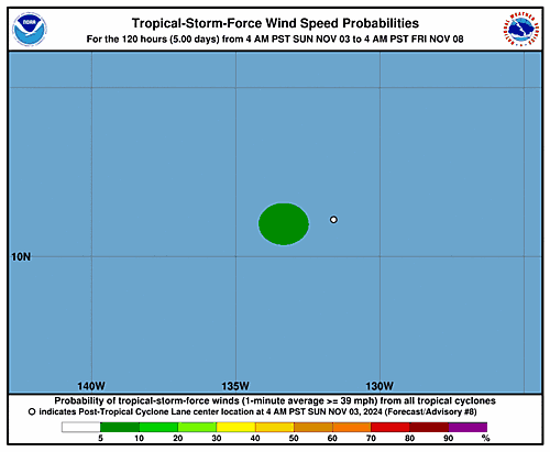
000 FOPZ13 KNHC 031449 PWSEP3 POST-TROPICAL CYCLONE LANE WIND SPEED PROBABILITIES NUMBER 8 NWS NATIONAL HURRICANE CENTER MIAMI FL EP132024 1500 UTC SUN NOV 03 2024 AT 1500Z THE CENTER OF POST-TROPICAL CYCLONE LANE WAS LOCATED NEAR LATITUDE 11.1 NORTH...LONGITUDE 132.0 WEST WITH MAXIMUM SUSTAINED WINDS NEAR 25 KTS...30 MPH...45 KM/H. Z INDICATES COORDINATED UNIVERSAL TIME (GREENWICH) PACIFIC STANDARD TIME (PST)...SUBTRACT 8 HOURS FROM Z TIME HAWAIIAN STANDARD TIME (HST)...SUBTRACT 10 HOURS FROM Z TIME WIND SPEED PROBABILITY TABLE FOR SPECIFIC LOCATIONS CHANCES OF SUSTAINED (1-MINUTE AVERAGE) WIND SPEEDS OF AT LEAST ...34 KT (39 MPH... 63 KM/H)... ...50 KT (58 MPH... 93 KM/H)... ...64 KT (74 MPH...119 KM/H)... FOR LOCATIONS AND TIME PERIODS DURING THE NEXT 5 DAYS PROBABILITIES FOR LOCATIONS ARE GIVEN AS OP(CP) WHERE OP IS THE PROBABILITY OF THE EVENT BEGINNING DURING AN INDIVIDUAL TIME PERIOD (ONSET PROBABILITY) (CP) IS THE PROBABILITY OF THE EVENT OCCURRING BETWEEN 12Z SUN AND THE FORECAST HOUR (CUMULATIVE PROBABILITY) PROBABILITIES ARE GIVEN IN PERCENT X INDICATES PROBABILITIES LESS THAN 1 PERCENT PROBABILITIES FOR 34 KT AND 50 KT ARE SHOWN AT A GIVEN LOCATION WHEN THE 5-DAY CUMULATIVE PROBABILITY IS AT LEAST 3 PERCENT. PROBABILITIES FOR 34...50...64 KT SHOWN WHEN THE 5-DAY 64-KT CUMULATIVE PROBABILITY IS AT LEAST 1 PERCENT. - - - - WIND SPEED PROBABILITIES FOR SELECTED LOCATIONS - - - - FROM FROM FROM FROM FROM FROM FROM TIME 12Z SUN 00Z MON 12Z MON 00Z TUE 12Z TUE 12Z WED 12Z THU PERIODS TO TO TO TO TO TO TO 00Z MON 12Z MON 00Z TUE 12Z TUE 12Z WED 12Z THU 12Z FRI FORECAST HOUR (12) (24) (36) (48) (72) (96) (120) - - - - - - - - - - - - - - - - - - - - - - - - - - - - - - - - - - LOCATION KT 10N 135W 34 X 1( 1) 2( 3) X( 3) X( 3) X( 3) X( 3) $$ FORECASTER BUCCI
, UTC by admin
Issued at 700 AM PST Sun Nov 03 2024
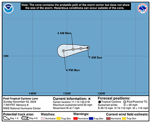
000 WTPZ43 KNHC 031449 TCDEP3 Post-Tropical Cyclone Lane Discussion Number 8 NWS National Hurricane Center Miami FL EP132024 700 AM PST Sun Nov 03 2024 Lane has degenerated into a remnant low. The exposed low-level circulation is well separated from deep convection associated with the monsoon trough based on geostationary satellite imagery. The low is expected to move just south of west for the next couple of days in the near surface flow. Lane should open into a trough by mid-week, however this could occur sooner. This is the last NHC advisory on this system. FORECAST POSITIONS AND MAX WINDS INIT 03/1500Z 11.1N 132.0W 25 KT 30 MPH...POST-TROP/REMNT LOW 12H 04/0000Z 11.0N 133.0W 25 KT 30 MPH...POST-TROP/REMNT LOW 24H 04/1200Z 10.9N 134.1W 20 KT 25 MPH...POST-TROP/REMNT LOW 36H 05/0000Z 10.7N 135.5W 20 KT 25 MPH...POST-TROP/REMNT LOW 48H 05/1200Z...DISSIPATED $$ Forecaster Bucci
, UTC by admin
, UTC by nhcauto
, UTC by admin
Issued at 700 AM PST Sun Nov 03 2024
000 WTPZ33 KNHC 031448 TCPEP3 BULLETIN Post-Tropical Cyclone Lane Advisory Number 8 NWS National Hurricane Center Miami FL EP132024 700 AM PST Sun Nov 03 2024 ...LANE BECOMES A REMNANT LOW... SUMMARY OF 700 AM PST...1500 UTC...INFORMATION ---------------------------------------------- LOCATION...11.1N 132.0W ABOUT 1670 MI...2685 KM WSW OF THE SOUTHERN TIP OF BAJA CALIFORNIA MAXIMUM SUSTAINED WINDS...30 MPH...45 KM/H PRESENT MOVEMENT...W OR 265 DEGREES AT 7 MPH...11 KM/H MINIMUM CENTRAL PRESSURE...1008 MB...29.77 INCHES WATCHES AND WARNINGS -------------------- There are no coastal watches or warnings in effect. DISCUSSION AND OUTLOOK ---------------------- At 700 AM PST (1500 UTC), the center of Post-Tropical Cyclone Lane was located near latitude 11.1 North, longitude 132.0 West. The post-tropical cyclone is moving toward the west near 7 mph (11 km/h), and a slightly south of westward motion is expected for the next day or two. Maximum sustained winds are near 30 mph (45 km/h) with higher gusts. Continued weakening is forecast, and the remnant low is expected to dissipate within the next couple of days or sooner. The estimated minimum central pressure is 1008 mb (29.77 inches). HAZARDS AFFECTING LAND ---------------------- None. NEXT ADVISORY ------------- This is the last public advisory issued by the National Hurricane Center on this system. $$ Forecaster Bucci
, UTC by admin
Issued at 1500 UTC SUN NOV 03 2024
000 WTPZ23 KNHC 031448 TCMEP3 POST-TROPICAL CYCLONE LANE FORECAST/ADVISORY NUMBER 8 NWS NATIONAL HURRICANE CENTER MIAMI FL EP132024 1500 UTC SUN NOV 03 2024 POST-TROPICAL CYCLONE CENTER LOCATED NEAR 11.1N 132.0W AT 03/1500Z POSITION ACCURATE WITHIN 30 NM PRESENT MOVEMENT TOWARD THE WEST OR 265 DEGREES AT 6 KT ESTIMATED MINIMUM CENTRAL PRESSURE 1008 MB MAX SUSTAINED WINDS 25 KT WITH GUSTS TO 35 KT. WINDS AND SEAS VARY GREATLY IN EACH QUADRANT. RADII IN NAUTICAL MILES ARE THE LARGEST RADII EXPECTED ANYWHERE IN THAT QUADRANT. REPEAT...CENTER LOCATED NEAR 11.1N 132.0W AT 03/1500Z AT 03/1200Z CENTER WAS LOCATED NEAR 11.1N 131.6W FORECAST VALID 04/0000Z 11.0N 133.0W...POST-TROP/REMNT LOW MAX WIND 25 KT...GUSTS 35 KT. FORECAST VALID 04/1200Z 10.9N 134.1W...POST-TROP/REMNT LOW MAX WIND 20 KT...GUSTS 30 KT. FORECAST VALID 05/0000Z 10.7N 135.5W...POST-TROP/REMNT LOW MAX WIND 20 KT...GUSTS 30 KT. FORECAST VALID 05/1200Z...DISSIPATED REQUEST FOR 3 HOURLY SHIP REPORTS WITHIN 300 MILES OF 11.1N 132.0W THIS IS THE LAST FORECAST/ADVISORY ISSUED BY THE NATIONAL HURRICANE CENTER ON THIS SYSTEM $$ FORECASTER BUCCI
, UTC by nhcauto
Issued at 1500 UTC SUN NOV 03 2024
412 FONT12 KNHC 031433 PWSAT2 SUBTROPICAL STORM PATTY WIND SPEED PROBABILITIES NUMBER 6 NWS NATIONAL HURRICANE CENTER MIAMI FL AL172024 1500 UTC SUN NOV 03 2024 AT 1500Z THE CENTER OF SUBTROPICAL STORM PATTY WAS LOCATED NEAR LATITUDE 37.5 NORTH...LONGITUDE 24.3 WEST WITH MAXIMUM SUSTAINED WINDS NEAR 40 KTS...45 MPH...75 KM/H. Z INDICATES COORDINATED UNIVERSAL TIME (GREENWICH) ATLANTIC STANDARD TIME (AST)...SUBTRACT 4 HOURS FROM Z TIME EASTERN STANDARD TIME (EST)...SUBTRACT 5 HOURS FROM Z TIME CENTRAL STANDARD TIME (CST)...SUBTRACT 6 HOURS FROM Z TIME WIND SPEED PROBABILITY TABLE FOR SPECIFIC LOCATIONS CHANCES OF SUSTAINED (1-MINUTE AVERAGE) WIND SPEEDS OF AT LEAST ...34 KT (39 MPH... 63 KM/H)... ...50 KT (58 MPH... 93 KM/H)... ...64 KT (74 MPH...119 KM/H)... FOR LOCATIONS AND TIME PERIODS DURING THE NEXT 5 DAYS PROBABILITIES FOR LOCATIONS ARE GIVEN AS OP(CP) WHERE OP IS THE PROBABILITY OF THE EVENT BEGINNING DURING AN INDIVIDUAL TIME PERIOD (ONSET PROBABILITY) (CP) IS THE PROBABILITY OF THE EVENT OCCURRING BETWEEN 12Z SUN AND THE FORECAST HOUR (CUMULATIVE PROBABILITY) PROBABILITIES ARE GIVEN IN PERCENT X INDICATES PROBABILITIES LESS THAN 1 PERCENT PROBABILITIES FOR 34 KT AND 50 KT ARE SHOWN AT A GIVEN LOCATION WHEN THE 5-DAY CUMULATIVE PROBABILITY IS AT LEAST 3 PERCENT. PROBABILITIES FOR 34...50...64 KT SHOWN WHEN THE 5-DAY 64-KT CUMULATIVE PROBABILITY IS AT LEAST 1 PERCENT. - - - - WIND SPEED PROBABILITIES FOR SELECTED LOCATIONS - - - - FROM FROM FROM FROM FROM FROM FROM TIME 12Z SUN 00Z MON 12Z MON 00Z TUE 12Z TUE 12Z WED 12Z THU PERIODS TO TO TO TO TO TO TO 00Z MON 12Z MON 00Z TUE 12Z TUE 12Z WED 12Z THU 12Z FRI FORECAST HOUR (12) (24) (36) (48) (72) (96) (120) - - - - - - - - - - - - - - - - - - - - - - - - - - - - - - - - - - LOCATION KT PONTA DELGADA 34 7 X( 7) X( 7) X( 7) X( 7) X( 7) X( 7) $$ FORECASTER CANGIALOSI
, UTC by nhcauto
Issued at 300 PM GMT Sun Nov 03 2024
000 WTNT42 KNHC 031434 TCDAT2 Subtropical Storm Patty Discussion Number 6 NWS National Hurricane Center Miami FL AL172024 300 PM GMT Sun Nov 03 2024 Patty is beginning to pull away from the Azores, with the center now just east of the easternmost islands. The storm is also on its way to becoming a post-tropical cyclone as deep convection has been absent for more than 6 hours. Recent ASCAT-A and ASCAT-B passes show peak winds in the 35-40 kt range, and based on that data and the degraded satellite appearance, the initial intensity is lowered to 40 kt. The strongest winds are occurring on the system's south side, just south of the easternmost Azores. Very strong westerly vertical wind shear, stable air, and cool waters should continue to cause weakening, and Patty will likely degenerate into a post-tropical cyclone in the next 6 to 12 hours. Dissipation has been moved up to 60 h based on the latest global model guidance. Patty is moving eastward at 14 kt in relatively zonal flow, and an eastward to east-northeastward toward western Europe is expected until the system dissipates. The NHC track forecast is near the middle of the guidance envelope. FORECAST POSITIONS AND MAX WINDS INIT 03/1500Z 37.5N 24.3W 40 KT 45 MPH 12H 04/0000Z 37.3N 21.2W 35 KT 40 MPH...POST-TROPICAL 24H 04/1200Z 38.3N 16.9W 30 KT 35 MPH...POST-TROP/REMNT LOW 36H 05/0000Z 39.7N 12.9W 30 KT 35 MPH...POST-TROP/REMNT LOW 48H 05/1200Z 40.8N 10.5W 25 KT 30 MPH...POST-TROP/REMNT LOW 60H 06/0000Z...DISSIPATED $$ Forecaster Cangialosi
, UTC by atlanticnhc
Issued at 1500 UTC SUN NOV 03 2024
000 WTNT22 KNHC 031433 TCMAT2 SUBTROPICAL STORM PATTY FORECAST/ADVISORY NUMBER 6 NWS NATIONAL HURRICANE CENTER MIAMI FL AL172024 1500 UTC SUN NOV 03 2024 SUBTROPICAL STORM CENTER LOCATED NEAR 37.5N 24.3W AT 03/1500Z POSITION ACCURATE WITHIN 30 NM PRESENT MOVEMENT TOWARD THE EAST OR 100 DEGREES AT 14 KT ESTIMATED MINIMUM CENTRAL PRESSURE 992 MB MAX SUSTAINED WINDS 40 KT WITH GUSTS TO 45 KT. 34 KT....... 0NE 50SE 70SW 0NW. 12 FT SEAS.. 60NE 300SE 480SW 240NW. WINDS AND SEAS VARY GREATLY IN EACH QUADRANT. RADII IN NAUTICAL MILES ARE THE LARGEST RADII EXPECTED ANYWHERE IN THAT QUADRANT. REPEAT...CENTER LOCATED NEAR 37.5N 24.3W AT 03/1500Z AT 03/1200Z CENTER WAS LOCATED NEAR 37.5N 25.4W FORECAST VALID 04/0000Z 37.3N 21.2W...POST-TROPICAL MAX WIND 35 KT...GUSTS 45 KT. 34 KT... 0NE 50SE 70SW 0NW. FORECAST VALID 04/1200Z 38.3N 16.9W...POST-TROP/REMNT LOW MAX WIND 30 KT...GUSTS 40 KT. FORECAST VALID 05/0000Z 39.7N 12.9W...POST-TROP/REMNT LOW MAX WIND 30 KT...GUSTS 40 KT. FORECAST VALID 05/1200Z 40.8N 10.5W...POST-TROP/REMNT LOW MAX WIND 25 KT...GUSTS 35 KT. FORECAST VALID 06/0000Z...DISSIPATED REQUEST FOR 3 HOURLY SHIP REPORTS WITHIN 300 MILES OF 37.5N 24.3W INTERMEDIATE PUBLIC ADVISORY...WTNT32 KNHC/MIATCPAT2...AT 03/1800Z NEXT ADVISORY AT 03/2100Z $$ FORECASTER CANGIALOSI
, UTC by atlanticnhc
Issued at 300 PM GMT Sun Nov 03 2024
000 WTNT32 KNHC 031433 TCPAT2 BULLETIN Subtropical Storm Patty Advisory Number 6 NWS National Hurricane Center Miami FL AL172024 300 PM GMT Sun Nov 03 2024 ...PATTY BEGINNING TO PULL AWAY FROM THE AZORES... ...EXPECTED TO BECOME A POST-TROPICAL CYCLONE LATER TODAY OR TONIGHT... SUMMARY OF 300 PM GMT...1500 UTC...INFORMATION ---------------------------------------------- LOCATION...37.5N 24.3W ABOUT 175 MI...285 KM ESE OF LAJES AIR BASE IN THE AZORES MAXIMUM SUSTAINED WINDS...45 MPH...75 KM/H PRESENT MOVEMENT...E OR 100 DEGREES AT 16 MPH...26 KM/H MINIMUM CENTRAL PRESSURE...992 MB...29.30 INCHES WATCHES AND WARNINGS -------------------- CHANGES WITH THIS ADVISORY: None. SUMMARY OF WATCHES AND WARNINGS IN EFFECT: A Tropical Storm Warning is in effect for... * All of the Azores A Tropical Storm Warning means that tropical storm conditions are expected somewhere within the warning area. For storm information specific to your area, please monitor products issued by your national meteorological service. DISCUSSION AND OUTLOOK ---------------------- At 300 PM GMT (1500 UTC), the center of Subtropical Storm Patty was located near latitude 37.5 North, longitude 24.3 West. The storm is moving toward the east near 16 mph (26 km/h) and an eastward to east-northeastward motion is expected during the next couple of days. On the forecast track, the center of Patty is expected to pull away from the Azores. Maximum sustained winds are near 45 mph (75 km/h) with higher gusts. Weakening is expected during the next couple of days, and Patty is forecast to become a post-tropical low later today or tonight. Winds of 40 mph extend outward up to 80 miles (130 km) from the center. The estimated minimum central pressure is 992 mb (29.30 inches). HAZARDS AFFECTING LAND ---------------------- WIND: Tropical storm conditions are expected in the Azores for the next few hours. RAINFALL: Patty is expected to produce rainfall amounts of 1 to 2 inches (25 to 50 millimeters) with local amounts to 4 inches (100 mm) across the Azores through early Monday. SURF: Swells generated by Patty will affect the Azores through tonight. These swells are likely to cause life-threatening surf and rip current conditions. Please consult products from your local weather office. NEXT ADVISORY ------------- Next intermediate advisory at 600 PM GMT. Next complete advisory at 900 PM GMT. $$ Forecaster Cangialosi
, UTC by nhcauto
, UTC by atlanticnhc
Issued at 1200 PM GMT Sun Nov 03 2024
000 WTNT32 KNHC 031142 TCPAT2 BULLETIN Subtropical Storm Patty Intermediate Advisory Number 5A NWS National Hurricane Center Miami FL AL172024 1200 PM GMT Sun Nov 03 2024 ...PATTY VERY NEAR SAO MIGUEL ISLAND... SUMMARY OF 1200 PM GMT...1200 UTC...INFORMATION ----------------------------------------------- LOCATION...37.5N 25.5W ABOUT 125 MI...200 KM SE OF LAJES AIR BASE IN THE AZORES MAXIMUM SUSTAINED WINDS...50 MPH...85 KM/H PRESENT MOVEMENT...E OR 90 DEGREES AT 18 MPH...30 KM/H MINIMUM CENTRAL PRESSURE...990 MB...29.23 INCHES WATCHES AND WARNINGS -------------------- CHANGES WITH THIS ADVISORY: None. SUMMARY OF WATCHES AND WARNINGS IN EFFECT: A Tropical Storm Warning is in effect for... * All of the Azores A Tropical Storm Warning means that tropical storm conditions are expected somewhere within the warning area. For storm information specific to your area, please monitor products issued by your national meteorological service. DISCUSSION AND OUTLOOK ---------------------- At 1200 PM GMT (1200 UTC), the center of Subtropical Storm Patty was located near latitude 37.5 North, longitude 25.5 West. The storm is moving toward the east near 18 mph (30 km/h), and an eastward to east-northeastward motion is expected during the next couple of days. On the forecast track, the center of Patty is expected to move near the southeastern Azores during the next several hours. Maximum sustained winds are near 50 mph (85 km/h) with higher gusts. Weakening is expected during the next couple of days, and Patty is forecast to become a post-tropical low later today or early Monday. Winds of 40 mph extend outward up to 175 miles (280 km), mainly to the south and southwest of the center. The estimated minimum central pressure is 990 mb (29.23 inches). HAZARDS AFFECTING LAND ---------------------- WIND: Tropical storm conditions are expected in the Azores for the next several hours. RAINFALL: Patty is expected to produce rainfall amounts of 1 to 2 inches (25 to 50 millimeters) with local amounts to 4 inches (100 mm) across the Azores through early Monday. SURF: Swells generated by Patty will affect the Azores through tonight. These swells are likely to cause life-threatening surf and rip current conditions. Please consult products from your local weather office. NEXT ADVISORY ------------- Next complete advisory at 300 PM GMT. $$ Forecaster Cangialosi
, UTC by nhcauto
Issued at 0900 UTC SUN NOV 03 2024
000 FONT12 KNHC 030840 PWSAT2 SUBTROPICAL STORM PATTY WIND SPEED PROBABILITIES NUMBER 5 NWS NATIONAL HURRICANE CENTER MIAMI FL AL172024 0900 UTC SUN NOV 03 2024 AT 0900Z THE CENTER OF SUBTROPICAL STORM PATTY WAS LOCATED NEAR LATITUDE 37.9 NORTH...LONGITUDE 26.0 WEST WITH MAXIMUM SUSTAINED WINDS NEAR 45 KTS...50 MPH...85 KM/H. Z INDICATES COORDINATED UNIVERSAL TIME (GREENWICH) ATLANTIC STANDARD TIME (AST)...SUBTRACT 4 HOURS FROM Z TIME EASTERN STANDARD TIME (EST)...SUBTRACT 5 HOURS FROM Z TIME CENTRAL STANDARD TIME (CST)...SUBTRACT 6 HOURS FROM Z TIME WIND SPEED PROBABILITY TABLE FOR SPECIFIC LOCATIONS CHANCES OF SUSTAINED (1-MINUTE AVERAGE) WIND SPEEDS OF AT LEAST ...34 KT (39 MPH... 63 KM/H)... ...50 KT (58 MPH... 93 KM/H)... ...64 KT (74 MPH...119 KM/H)... FOR LOCATIONS AND TIME PERIODS DURING THE NEXT 5 DAYS PROBABILITIES FOR LOCATIONS ARE GIVEN AS OP(CP) WHERE OP IS THE PROBABILITY OF THE EVENT BEGINNING DURING AN INDIVIDUAL TIME PERIOD (ONSET PROBABILITY) (CP) IS THE PROBABILITY OF THE EVENT OCCURRING BETWEEN 06Z SUN AND THE FORECAST HOUR (CUMULATIVE PROBABILITY) PROBABILITIES ARE GIVEN IN PERCENT X INDICATES PROBABILITIES LESS THAN 1 PERCENT PROBABILITIES FOR 34 KT AND 50 KT ARE SHOWN AT A GIVEN LOCATION WHEN THE 5-DAY CUMULATIVE PROBABILITY IS AT LEAST 3 PERCENT. PROBABILITIES FOR 34...50...64 KT SHOWN WHEN THE 5-DAY 64-KT CUMULATIVE PROBABILITY IS AT LEAST 1 PERCENT. - - - - WIND SPEED PROBABILITIES FOR SELECTED LOCATIONS - - - - FROM FROM FROM FROM FROM FROM FROM TIME 06Z SUN 18Z SUN 06Z MON 18Z MON 06Z TUE 06Z WED 06Z THU PERIODS TO TO TO TO TO TO TO 18Z SUN 06Z MON 18Z MON 06Z TUE 06Z WED 06Z THU 06Z FRI FORECAST HOUR (12) (24) (36) (48) (72) (96) (120) - - - - - - - - - - - - - - - - - - - - - - - - - - - - - - - - - - LOCATION KT PONTA DELGADA 34 93 X(93) X(93) X(93) X(93) X(93) X(93) $$ FORECASTER REINHART
, UTC by nhcauto
Issued at 900 AM GMT Sun Nov 03 2024
000 WTNT42 KNHC 030840 TCDAT2 Subtropical Storm Patty Discussion Number 5 NWS National Hurricane Center Miami FL AL172024 900 AM GMT Sun Nov 03 2024 The center of Patty passed south of Terceira Island early this morning and is now approaching Sao Miguel Island in the southeastern Azores. Satellite images reveal the convective structure of the storm has degraded, with warming cloud tops and limited convection that has become displaced to the north and east of the center. Based on these trends and decreasing satellite intensity estimates, the intensity of Patty is lowered to 45 kt. The strongest winds are likely occurring to the south and southwest of the center. Scatterometer passes expected later this morning should provide more clarity on the storm's wind structure and current intensity. Patty is moving quickly eastward (090/16 kt) within mid-latitude westerlies over the northeastern Atlantic. A turn toward the east-northeast is forecast on Monday and Tuesday, in good agreement with the tightly clustered track guidance. No major changes were made to the updated NHC track forecast. The storm is already showing ill effects from westerly shear and dry air on its west side, and the environmental conditions are not expected to improve during the next couple of days. Therefore more weakening is anticipated, and Patty could lose organized convection and degenerate to a post-tropical cyclone by tonight or early Monday. Then, the global models indicate the low should gradually fill and eventually open into a trough by midweek near the coast of Portugal. Key Messages: 1. Tropical storm conditions are expected in portions of the Azores today, where Tropical Storm Warnings are in effect. 2. Locally heavy rains are possible across the Azores through early Monday. FORECAST POSITIONS AND MAX WINDS INIT 03/0900Z 37.9N 26.0W 45 KT 50 MPH 12H 03/1800Z 37.7N 22.9W 40 KT 45 MPH 24H 04/0600Z 38.1N 18.5W 35 KT 40 MPH...POST-TROPICAL 36H 04/1800Z 39.4N 14.3W 35 KT 40 MPH...POST-TROPICAL 48H 05/0600Z 40.9N 10.7W 30 KT 35 MPH...POST-TROP/REMNT LOW 60H 05/1800Z 42.1N 8.9W 25 KT 30 MPH...POST-TROP/REMNT LOW 72H 06/0600Z...DISSIPATED $$ Forecaster Reinhart
, UTC by nhcauto
, UTC by admin